The 1938 Hurricane on Long Island: A Timeline of the Storm and What It Did to the Coast
Landfall came between 2:15 and 2:45 on the afternoon of Wednesday, September 21, 1938, according to the National Weather Service’s account of the storm, and the NWS storm overview has the eye crossing Long Island’s South Shore near Bellport. PBS’s American Experience puts the eye at Bayport at 2:30, a neighboring community, so the two accounts differ on the spot while agreeing on the hour. By 3:00 the NWS has the center near Centereach, well north of the coast it had crossed half an hour earlier.
What follows takes that afternoon in order, from the forecast that never used the word hurricane to the ferries on Long Island Sound, the barrier beaches, the North Shore villages and the rebuilding. Numbers for deaths, damage and destroyed houses vary from source to source, sometimes widely. Rather than pick one, a table near the end sets them side by side.
What forecasters saw before the storm
Forecasters expected the storm to curve out to sea, according to Climate.gov’s history of the hurricane, and most ships had headed for port, which left the storm largely unobserved. It then roughly tripled its northward speed. Forecasts issued for the Eastern Seaboard that day carried high-wind and gale advisories but no mention of a hurricane, and the trip from Cape Hatteras to Long Island, about 425 miles, took less than eight hours.
An upper-level ridge that kept the storm from escaping to sea and a deepening trough over the eastern United States steered it toward the coast, according to the weather service’s meteorological summary. A 2013 reanalysis by Landsea and colleagues, which the page cites, now rates the storm a Category 3 at landfall. Earlier analyses had called it a strong Category 2.
Forward speed is reported two ways. PBS describes the storm moving at more than 60 miles an hour, “at least twice as fast as normal,” while the NWS gives 47 mph as it raced through eastern Long Island and southern Connecticut. The figures may describe different stretches of the track; neither page says.
About 1:00 p.m.: the Sound
PBS has the storm east of Atlantic City, New Jersey, at 1:00, roughly ninety minutes before it reached Long Island. On the Sound, a Port Jefferson ferry bound for Bridgeport had left at about that hour, and the NWS history says conditions worsened so quickly that the boat could not continue.
Beverly Tyler, writing for TBR News Media in 2023, names the vessel as the steamer Park City and gives its departure as 2 p.m. The NWS and Tyler do not agree on the hour, and neither source reconciles the difference. Tyler writes that the boat was not heard from until it was found anchored in the Sound with a flooded boiler. Eighteen to twenty hours passed before the Coast Guard towed it back, with two crew members, three women, a baby and two men aboard.
A separate crossing is described by the Suffolk Times North Fork History Project, which has Captain Clarence Sherman taking a ferry about halfway across the Sound in winds the article puts at 125 miles an hour. He reached Groton, Connecticut, after ten hours.
2:15 to 3:00 p.m.: landfall on the South Shore
About 50 miles wide when it reached Long Island, the eye carried barometric pressure of 27.94 inches, PBS reports. Winds approached 100 mph with gusts estimated at 120 on Fishers Island. Newsday gives the maximum sustained winds as 120 mph. The NWS storm overview puts the surge at 17 feet above normal high tide.
Fire Island took the worst of it first. At Saltaire, gusts probably reached at least 100 mph, the eye passed over, and then the surge arrived, which the NWS history calls “the most horrifying aspect of the hurricane.” The water split Saltaire in half and opened one of the many new inlets formed that day. More than 200 homes on Fire Island were completely destroyed. A longer account of how that barrier beach lost its original shore road appears in The Dune Road That Drowned.
Footage from the period survives. The newsreel below, uploaded by the PublicDomainFootage channel, is one of the videos the National Weather Service links from its own 1938 hurricane page.
Survivors interviewed for a 2018 anniversary story by Patricia Kitchen in Newsday, carried by New York Sea Grant, were children when the water came. Jackie Parlato Bennett, who was four, recalled: “Somebody’s house came across the bay and landed at our back door.” Otis Bradley, then six, described watching the surge: “You could see that water coming in — and coming in and coming in.” Water rose to windowsills in some homes, the story reports, and boats, cars and houses were carried off their sites.
Westhampton, Dune Road and the East End
Conditions worsened with each mile eastward on Long Island, PBS reports. The NWS reports that 29 people died at Westhampton Beach and that about 153 of 179 homes there were destroyed. PBS reaches the same count from the other direction, saying only 26 of 179 stood afterward. Dan Rattiner, writing in Dan’s Papers in 2018, describes nearly 200 homes strung along Dune Road’s ten miles, of which only 24 survived, with the rest “swept away as if they had never been.”
Rattiner also tells of a Westhampton plumber, Louis Green, who rode a floating roof to Oneck Point and came ashore covered in green paint from burst barrels. Montauk, he writes, was cut off from the outside with no radio contact and no rail service. The New York State Police history page adds that flooding across the South Fork turned Montauk into an island for a time and destroyed Long Island Rail Road track.
One lasting change came in the form of water. Dr. Andrew Morang of the Army Corps of Engineers’ Coastal Inlets Research Program, in a photographic history of Shinnecock Inlet, says the inlet was cut during the storm where a channel crossed from the bay to the road. That channel may have been left over from an inlet dug by the Shinnecock and Peconic Canal Company in 1896. A companion page at Stony Brook University pairs a June 30, 1938 photograph of the barrier before the breach with the inlet in place by September 24. By February 1939, Suffolk County had built a 1,470-foot bulkhead along the west side of the inlet with Works Progress Administration support, and both jetties were complete by 1956. Rattiner notes that the cut, nearly a quarter-mile wide at first, “has remained open to this day.” Nassau County’s emergency management history adds that the storm widened Moriches Inlet.
The National Weather Service’s New York office also published a video titled “Honoring 80+ Years of Cooperative Service / ’38 Hurricane Review,” which its 1938 hurricane page lists as an interview with Richard G. Hendrickson.
The North Shore and the Sound
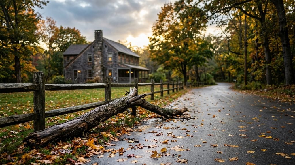
Across the North Shore villages, the accounts Tyler collects are mostly about wind and fallen trees. They list about a dozen trees down around Setauket by the postmaster’s count, roughly 25 between the village green and the Catholic church, and around 100 at Wide Water. In Stony Brook, the locust trees along Christian Avenue were largely destroyed.
Power took longer to return than the wind took to pass. Forrest West, quoted by Tyler, recalled: “We were without electricity for 13 days.” That figure refers to East Setauket.
Across the Peconic Bay, the North Fork fared differently from the South Fork. The Suffolk Times says it recorded one death, that of Emmett Young of Southold, while still taking real damage to waterfront property, docks and boats. The article notes that the North Fork “was on the right side of the hurricane,” the side of a storm that is always stronger.
How the sources count deaths, damage and lost houses
Published totals differ because they measure different things: Long Island alone or the whole region, a single village or a whole barrier beach, damage in 1938 dollars or in later dollars. The table collects the figures cited above, with what each covers.
| Source | Figure | What it covers |
|---|---|---|
| NWS New York, storm overview | About 700 deaths; $620 million in damage | Whole storm, Long Island and New England |
| Nassau County Office of Emergency Management | 700 deaths; $308 million; 63,000 homeless | Long Island and New England together |
| New York Fed, Liberty Street Economics (2012) | More than 600 deaths; about 57,000 homes destroyed or damaged; $306 million | Whole storm |
| Climate.gov | About 600 deaths; more than $300 million | Whole storm; estimates vary |
| Newsday (2018) | About 60 deaths | Long Island |
| NWS New York, history page | 29 deaths; about 153 of 179 homes destroyed | Westhampton Beach |
| PBS American Experience | Only 26 of 179 homes standing | Westhampton |
| Dan’s Papers (Rattiner, 2018) | Nearly 200 homes; 24 survived | Dune Road, ten miles |
| Suffolk Times | One death | North Fork |
Economists Jason Bram and Kara Masciangelo of the Federal Reserve Bank of New York add that, adjusted for inflation and increased wealth, the damage would be around $40 billion today, which as of 2012 they say could exceed preliminary estimates for Superstorm Sandy. That is a 2012 comparison, built on preliminary Sandy numbers, and not a current one.
Rebuilding, and what the storm left behind
In the New York Fed post’s words, coastal communities showed a rebound that was “fairly quick and rather strong,” helped by tax incentives and government support that facilitated rebuilt housing and protective works by the summer of 1939. Westhampton Beach, East Hampton and Southampton rebounded strongly, the authors write, and were still among the most affluent and vibrant local economies when the post appeared in 2012.
Shinnecock Inlet remains the most visible change to the map, with jetties on both sides since 1956. An earlier post on The Gilded Cottages of Oak Beach traces how Army Corps inlet stabilization and beach replenishment after 1938 shaped one South Shore colony, and the western end of the barrier island along Dune Road is covered in Where the Barrier Island Begins.
For anyone buying or owning near the water today, the 1938 record is background and not a prediction. Questions about flood zones, elevation and coverage belong with a licensed insurer, surveyor and attorney, and the site’s coverage of the Suffolk County flood zone remapping and of North Shore bluff erosion lays out how current maps and shoreline change bear on a purchase. Whether a particular house would be affected by a storm of this kind is not something history alone can answer.
Questions about the 1938 hurricane
What was the Long Island Express?
It is the nickname for the 1938 hurricane, also called the Great New England Hurricane. The New York State Police describe the storm as known by that name and as one of the deadliest and most destructive hurricanes to strike the East Coast.
Where and when did it make landfall?
The NWS places landfall between 2:15 and 2:45 p.m. on September 21, 1938, near Bellport. PBS puts the eye at Bayport at 2:30.
How many people died on Long Island?
Newsday’s 2018 account says about 60 lives were lost on Long Island, while the NWS reports 29 deaths at Westhampton Beach alone. Regional totals across Long Island and New England run from about 600 to about 700 depending on the source.
Did the North Shore feel the storm?
Yes, mainly through wind. Setauket and Stony Brook lost large numbers of trees, East Setauket reported 13 days without electricity, and ferries on the Sound were caught in the storm.

What did the hurricane create?
It cut Shinnecock Inlet, which remains open, and widened Moriches Inlet. At Saltaire on Fire Island, the NWS says the surge split the community and opened one of many inlets formed that day.
How often do hurricanes reach New England?
Climate.gov’s history of the storm says hurricanes reach New England about once a decade on average, citing twelve significant tropical cyclones making landfall over the prior eleven decades. That figure comes from an article written around 2010 and does not cover later seasons.
This is for informational purposes only — consult a licensed attorney or financial advisor for your specific situation.
You Might Also Like
- The Gilded Cottages of Oak Beach: How a Forgotten Colony of Victorian Summer Houses Survived a Century of Storms
- Historic Homes on Long Island: What Buyers Should Know Before Falling in Love With an Old House
- Why Long Island Homeowners Insurance Keeps Climbing — Even Away From the Flood Zone
- Scientists Just Rewrote How Ocean Currents Work — Here’s Why Your Coastal Property Should Care
Sources
- National Weather Service New York: The Great New England Hurricane of 1938, History
- National Weather Service New York: The Great New England Hurricane of 1938, Home
- National Weather Service New York: The Great New England Hurricane of 1938, Meteorology
- National Weather Service New York: The Great New England Hurricane of 1938, Video
- PBS American Experience: The Path of the Hurricane of ’38
- Climate.gov: The 1938 Great New England Hurricane
- New York State Police: Hurricane of 1938
- Federal Reserve Bank of New York, Liberty Street Economics: Historical Echoes, The Aftermath of a Devastating Hurricane in 1938 (November 30, 2012)
- Newsday via New York Sea Grant: 80 years later, vivid memories of historic Long Island Express hurricane (Patricia Kitchen, September 21, 2018)
- TBR News Media: History Close at Hand, The harrowing tale of the Long Island Express (Beverly C. Tyler, September 24, 2023)
- Suffolk Times: North Fork History Project, The Great Hurricane of 1938 makes landfall
- Dan’s Papers: 1938 Hurricane, Part III, Aftermath and Epilogue (Dan Rattiner, September 21, 2018)
- Coastal Inlets Research Program (Dr. Andrew Morang): Shinnecock Inlet photographic history
- Stony Brook University School of Marine and Atmospheric Sciences: Shinnecock Inlet and the 1938 hurricane (Morang, December 3, 2016)
- Nassau County Office of Emergency Management: History of Hurricanes
- YouTube, PublicDomainFootage: 1938 Hurricane slams East Coast, Public Domain Footage Newsreel
- YouTube, NWSNewYorkNY: Honoring 80+ Years of Cooperative Service / ’38 Hurricane Review