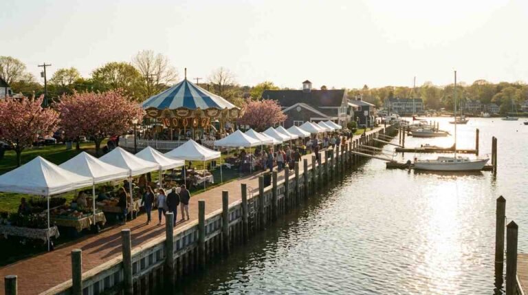
Strong’s Neck Road at Low Tide
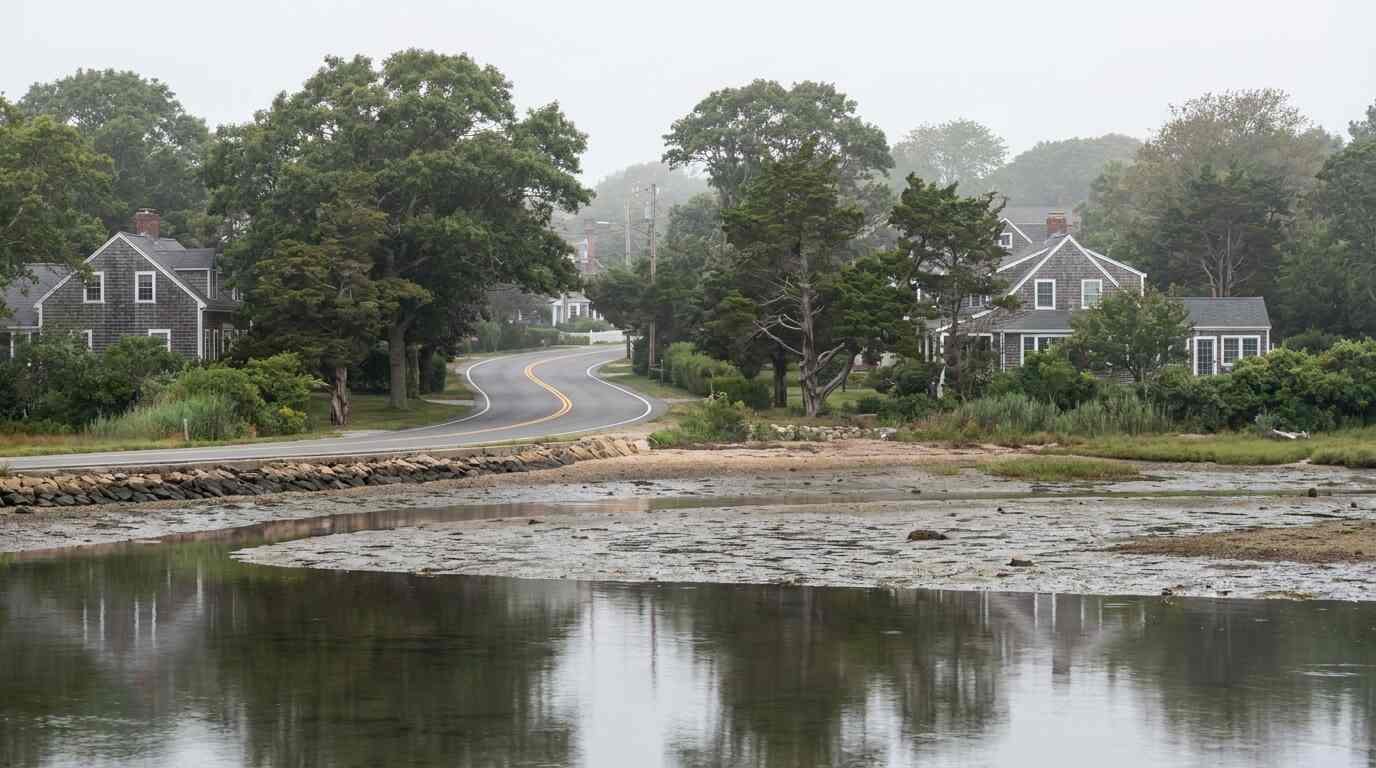
There is a particular stretch of road in Setauket that changes character entirely depending on the tide, the season, and the time of day. Drive it at 7am in May and it reads like coastal Maine — the water flat, the light horizontal, the shingle-and-cedar houses set back behind mature oaks. Drive it in July at noon and it’s Long Island again. The distinction matters, because buyers often arrive in the latter condition and make their offers before they’ve seen the former.
Strong’s Neck is a peninsula extending into Setauket Harbor on Long Island’s North Shore, surrounded on three sides by water: Conscience Bay to the west, Setauket Harbor curving around the south and east, and the Long Island Sound visible to the north on a clear day across Old Field. It sits within the Town of Brookhaven and carries the zip code 11733. The Strong’s Neck Civic Association maintains an active presence there, and the neighborhood has its own internal geography — roads named Dyke, Gaul, Bay, Bluff Lane, Temple, and Cemetery that trace the topography of the original land rather than the logic of a subdivision plat.
What “Waterfront” Actually Means Here
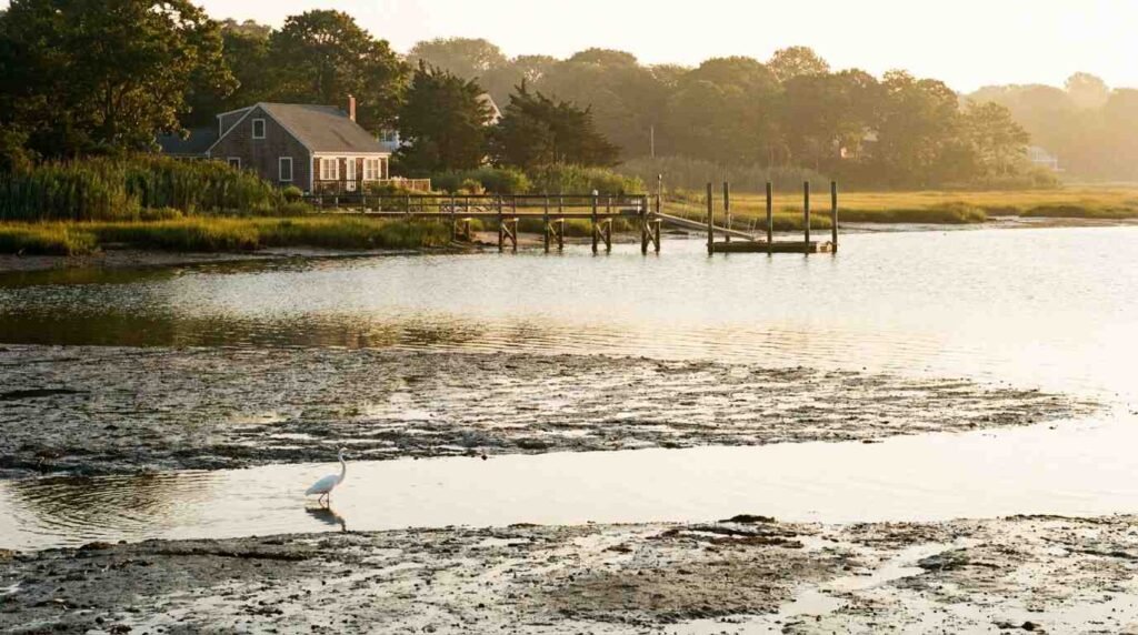
The word waterfront does a lot of work in North Shore real estate marketing, and it means different things in different places. On Strong’s Neck, waterfront can mean a Conscience Bay frontage with tidal marsh in the foreground and a working dock behind it, or a Setauket Harbor lot with a beach strip that disappears at high tide, or a bluff-line property on the Sound side where the elevation gives a view but the water is fifty feet below. Each of those carries a different maintenance reality, a different flood zone designation, and a different relationship between what the listing says and what a buyer will experience over time. What Makes a Long Island Waterfront Listing Worth the Premium — And How to Tell If It Is covers the technical distinctions in more depth, but the point is that this peninsula forces buyers to be specific about which kind of waterfront they are actually buying.
Conscience Bay, on the western edge of the neck, is tidal and protected — it has the character of an estuary more than open Sound. The water is warmer in summer and calmer in almost all conditions. Setauket Harbor, rounding the southern and eastern exposures, is more open and more subject to wind chop, though it remains far more sheltered than Sound-facing properties. Bluff properties on the northern edge of the peninsula have Sound exposure without direct water access, which means they typically carry Sound views, potential erosion risk, and significant elevation — a different trade than a flat lot with a dock. Any buyer working this area should distinguish which of those three they are evaluating before the first showing.
The Historical Layer That Never Quite Leaves
Strong’s Neck was originally known as Little Neck, the Setauket Indian word Minnesauke — a fact preserved in the name of one of the district’s elementary schools. It was purchased from the Setalcott Nation in 1662, became the property of William “Tangier” Smith in the 17th century, and passed through his family for generations. Smith’s great-granddaughter Anna married Selah Strong, the property took the family’s name, and by the time of the American Revolution, Anna Strong was using the farm’s clothesline as an active communications tool for the Culper Spy Ring.
The mechanism was precise: a black petticoat on the line meant that Caleb Brewster had arrived at the Sound. The number of handkerchiefs indicated which of the six possible landing coves Brewster was using. Abraham Woodhull, whose farm sat between Conscience Bay and Little Bay with a direct sightline to Anna’s property, would read the line through a spyglass, then get the dispatches to Brewster for the row across the Sound to Connecticut. The intelligence moved from Setauket to George Washington’s headquarters in Morristown, New Jersey. The Setauket Three and the Streets They Left Behind traces how that geography persists in the street layout of the area today.
Anna and Selah Strong are buried on the neck, in the Smith-Strong Family Graveyard, overlooking Little Bay. The graveyard is still there.
The Road Itself
The neck roads do not go anywhere in a destination sense. They loop, they dead-end at water, they pass between properties that have been on their lots since before the Republic. That quality — the absence of through traffic, the sense that the road exists for the neighborhood rather than for anyone passing through — is precisely what gives the area its character, and also what makes it invisible to buyers who navigate primarily from the LIE.
Strong’s Neck is not accessible from the Expressway with any directness. You come off 25A and work north, through Old Field Road or Dyke Road, and the peninsula reveals itself gradually. The character change is physical: the road narrows, the vegetation thickens, the houses stop presenting to the street and orient themselves instead toward the water. A buyer unfamiliar with this geography might never find the neighborhood without someone pointing them toward it specifically.

The Setauket Waterfront Is Not One Thing
Real estate marketing often treats “Setauket waterfront” as a single category. It is not. The Setauket neighborhood guide on this site covers the broader community’s character and schools, but the waterfront sub-geography has meaningful internal variation that only shows up when you walk the ground. Setauket and East Setauket, NY — The North Shore Neighborhood Guide covers the broader community and its context; Strong’s Neck is its own chapter within that story.
Strong’s Neck carries Three Village Central School District zoning, served primarily by the Minnesauke Elementary School — the school whose very name preserves the Setauket Indian word for the land the school now sits near. Properties range from post-war colonials to historic structures dating to the 1700s, with waterfront pricing reflecting the specific type of water access and the proximity to the civic association’s private beach at Minasseroke.
Buyers who have been burned by “waterfront-adjacent” listings on the North Shore often find, when they finally walk Strong’s Neck Road at low tide, that this is what they were looking for all along. It requires some specificity to locate, a clear sense of which water relationship is right for a given buyer, and ideally at least one visit during conditions that don’t photograph well — the overcast Tuesday, the November morning, the hour before the dock work starts. That is when the peninsula shows its actual character.
You Might Also Like
- Setauket and East Setauket, NY — The North Shore Neighborhood Guide
- Sound vs. Bay vs. Harbor: What the Water Type Actually Means for Your Maintenance Budget and Resale Value
- Flood Insurance on Long Island’s North Shore: What FEMA Maps Don’t Tell You About Sound-Facing Properties
Sources
- Strong’s Neck Civic Association: strongsneck.org
- Wikipedia — Strongs Neck, New York: en.wikipedia.org/wiki/Strongs_Neck,_New_York
- Wikipedia — Setauket, New York: en.wikipedia.org/wiki/Setauket,_New_York
- Untapped New York — Setauket historic sites: untappedcities.com
- Tri-Spy Tours — Culper Ring history: culper.com/history
- Stony Brook University — Culper Spy Ring: guides.library.stonybrook.edu