Paddling Setauket and Port Jefferson Harbors

Three connected stretches of sheltered water lie along the north shore between Stony Brook and Mount Sinai: Setauket Harbor, Port Jefferson Harbor and Mount Sinai Harbor. They differ in depth, tide behavior and public access, and each has a different set of launch points. This guide describes what published sources say about those launches, the tidal conditions, the rules that apply to paddlers and the seasonal wildlife that overlaps with late-autumn paddling. Some of the access information comes from older documents, and that is noted where it applies.
Setauket Harbor
Public access to Setauket Harbor centers on the Town of Brookhaven dock and beach on Shore Road in East Setauket. Brookhaven’s own account of Setauket Harbor Day places the annual event at that site, where activities in 2018 included boat tours, paddling and kayaking, fishing instruction and marine science displays. The Setauket Harbor Task Force, a Setauket-based nonprofit, hosts it. According to a 2019 report, the group advocates for improved water quality, community access and the protection and restoration of marine habitat. Editions have been held in late September, including September 29, 2018, September 28, 2019 and September 17, 2023 (the last per TBR), and no 2026 date was found.
A user-contributed listing on Paddling.com describes a public dock and a beach put-in, calm water, and manageable currents across most of the harbor with more caution advised near the mouth and in narrow sections. The same listing carries a reviewer’s remark that the beach is very soft at low tide, making the dock the drier choice. It also reports that parking is limited to town residents from Memorial Day to Labor Day, with no street parking and quick towing. Those are reviewer observations rather than official rules, so the Town of Brookhaven is the right place to confirm them.
The reviewer’s comment illustrates why the tide table matters at a put-in: the same site can be a firm beach at one hour and a soft, inconvenient one a few hours later.
Port Jefferson Harbor
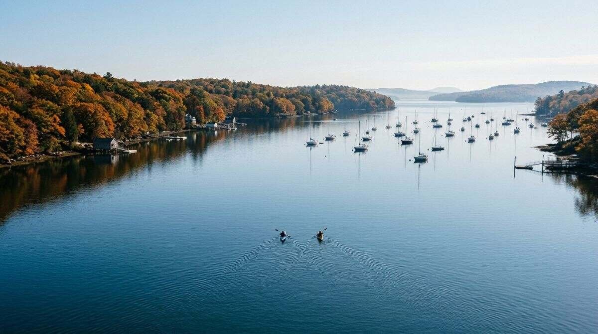
Port Jefferson Harbor covers about 990 acres, according to the New York Department of State’s habitat narrative, and it lies between Strongs Neck and Mount Misery. Depths are mostly 6 to 30 feet below mean low water, with some areas deeper than 50 feet, and the tidal range is about 7 feet. A tidal swing of that size produces visible changes in the shoreline, and the northern part of the harbor serves as feeding habitat for shorebirds.
A 2009 New York State Department of Environmental Conservation boat ramp guide for Brookhaven lists two launches on this harbor. The Village of Poquott ramp on Washington Avenue is described as a cobble ramp that depends on the tide, suited to small boats under 20 feet and with very limited parking. The Port Jefferson Boat Ramp on Route 25A is a multi-lane concrete ramp with room for 75 trailer rigs and requires a permit or day-use fee. The guide itself says conditions may have changed since its assessment, so it works best as a map of where launches exist rather than a statement of today’s rules.
The village has also run a kayak rack program for residents. A 2016 report described racks at Centennial Park, on the harbor near the yacht club, and at the beach at the end of Crystal Brook Hollow Road on Mount Sinai Harbor, allocated by lottery with one boat per household and a $10 administrative fee. Those terms are a decade old, so current availability needs to be confirmed with Village Hall.
Parking at Brookhaven’s Port Jefferson Marina operates by pay station, according to the town’s parking page, and the marina is open 24 hours. The same page lists a $25 daily rate or $150 weekly rate for Port Jefferson and Sandspit marinas.
Mount Sinai Harbor
Mount Sinai Harbor is the shallowest of the three. The state’s habitat narrative puts it at about 470 acres of salt marsh, intertidal mudflats and open water, owned by the Town of Brookhaven and managed for conservation, and says most of the harbor is under 6 feet deep at mean low water. Water that shallow suggests that the timing of the tide matters even more here than in the deeper Port Jefferson Harbor, though the narrative itself does not give paddling advice.
The 2009 ramp guide lists Cedar Beach Park on Harbor Beach Road, with a multi-lane concrete ramp, and a cobble, tide-dependent Shore Road ramp for small boats with very limited parking. Both require a permit or day-use fee, and a private marina on Harbor Beach Road is also listed. The Long Island Sound Study’s stewardship atlas entry describes the area as one of the few large, undeveloped embayments left on the North Shore, with bathing beaches, a town marina and a nature center at Cedar Beach.

Conscience Bay and nearby water
Conscience Bay appears in older local coverage as a place where kayaks and canoes are seen, along with Setauket Harbor and Smithtown Bay, in a 2011 Patch article. The article also describes a launch spot on Shore Road. Because that coverage is more than a decade old and no official launch listing for Conscience Bay turned up, details for it are left to the town.
Reading the tide
NOAA publishes tide predictions through its Tides and Currents prediction tool, which offers daily and calendar views for up to 31 days at a time and downloadable tables. The site cautions that the predictions are raw data without quality control and are for limited public use. In practice, the numbers that count are the time of low water, which determines whether a cobble or soft-sand put-in is usable, and the hours of strongest flow, which are most pronounced near harbor mouths and narrow sections according to the Paddling.com listing.
Rules, permits and safety
Brookhaven’s town parking page for 2026 lists a resident seasonal permit at $32 for the first vehicle, covering town beaches, pools and marinas, a non-resident permit at $358, and pay-as-you-go rates of $4 per hour Monday to Thursday and $5 per hour Friday to Sunday and holidays. Daily rates are $20 and $25 for the same periods. The page names Cedar Beach and the Port Jefferson Marina among locations with pay stations. Whether a given ramp or beach is covered by those rates is something the town answers; the 2009 ramp guide says permits or day-use fees apply to ramps not run by the state.
Shellfishing is a separate matter. The state narrative for Mount Sinai Harbor says shellfishing there is restricted to Brookhaven residents and that about 63 percent of the area is certified, which is a reminder that harvesting rules differ from paddling rules.
On the water itself, the New York State Parks page on paddlecraft requires a properly fitting, Coast Guard-approved life jacket for each person aboard, requires children under 12 to wear one, and requires a white light such as a waterproof flashlight. Manually propelled canoes, kayaks and paddleboards do not need registration, and a boating safety course is recommended but not required. The state’s DEC paddling page adds that everyone on a pleasure vessel under 21 feet must wear a life jacket from November 1 to May 1, and warns that cold-water immersion can quickly cause hypothermia.
Late October falls just before that November 1 start date.

Seasonal wildlife and guided options
The state narratives place wintering waterfowl in Port Jefferson Harbor from November through March, and they note that juvenile Atlantic ridley sea turtles may use both Port Jefferson and Mount Sinai harbors between about August 15 and December 15. Birdwatching from the water is covered in more detail in a companion guide on harbor birding.
Guided paddling is available from outfitters. Paumanok Tours lists Port Jefferson Harbor, Mount Sinai Harbor and Setauket Harbor among its paddling locations, including a Tri-Spy Tour in Setauket Harbor that covers marine life and the harbor’s role in George Washington’s spy ring, according to its website. A Long Island Press guide from 2020 lists the same waterways. Naming one operator here is informational and is not a ranking.
Related reading
Tidal conditions along the same shoreline are discussed in a walk along Strongs Neck Road at low tide, and the Setauket Harbor study covers water-quality context. This article is general information based on the sources linked in the text and is not navigation advice.
Useful gear
- NRS Sea Kayak Rescue Paddle Float: a related item for this activity. See it on Amazon (affiliate link)
As an Amazon Associate I earn from qualifying purchases. A commission may be earned if you buy through this link, at no extra cost to you.
Hours, programs and prices change; confirm details with the official sources linked above before visiting.
Sources
- Setauket Harbor Day announcement (Town of Brookhaven)
- Annual Setauket Harbor Day highlights local waterway (TBR News Media, 2019)
- Setauket Harbor Day highlights local waterfront's beauty (TBR News Media, 2023)
- Setauket Harbor (Paddling.com)
- Port Jefferson Harbor (NY Department of State habitat narrative)
- Mount Sinai Harbor (NY Department of State habitat narrative)
- Boat ramps in Brookhaven (NYS DEC guide)
- Kayak rack applications are back (TBR News Media, 2016)
- Parking Information (Town of Brookhaven)
- Mount Sinai and Port Jefferson Harbor (Long Island Sound Study stewardship atlas)
- Get your kayak on (Patch, 2011)
- NOAA Tides and Currents tide predictions
- Paddlecraft and Sailboats (NYS Parks)
- Paddling (NYS DEC)
- Paumanok Tours
- A rookie guide to Long Island kayak and paddleboard destinations (Long Island Press, 2020)