The Bridge That Determines Everything: How the Ponquogue Bridge Drawspan Choke Point Controls Real Estate Pricing on Dune Road
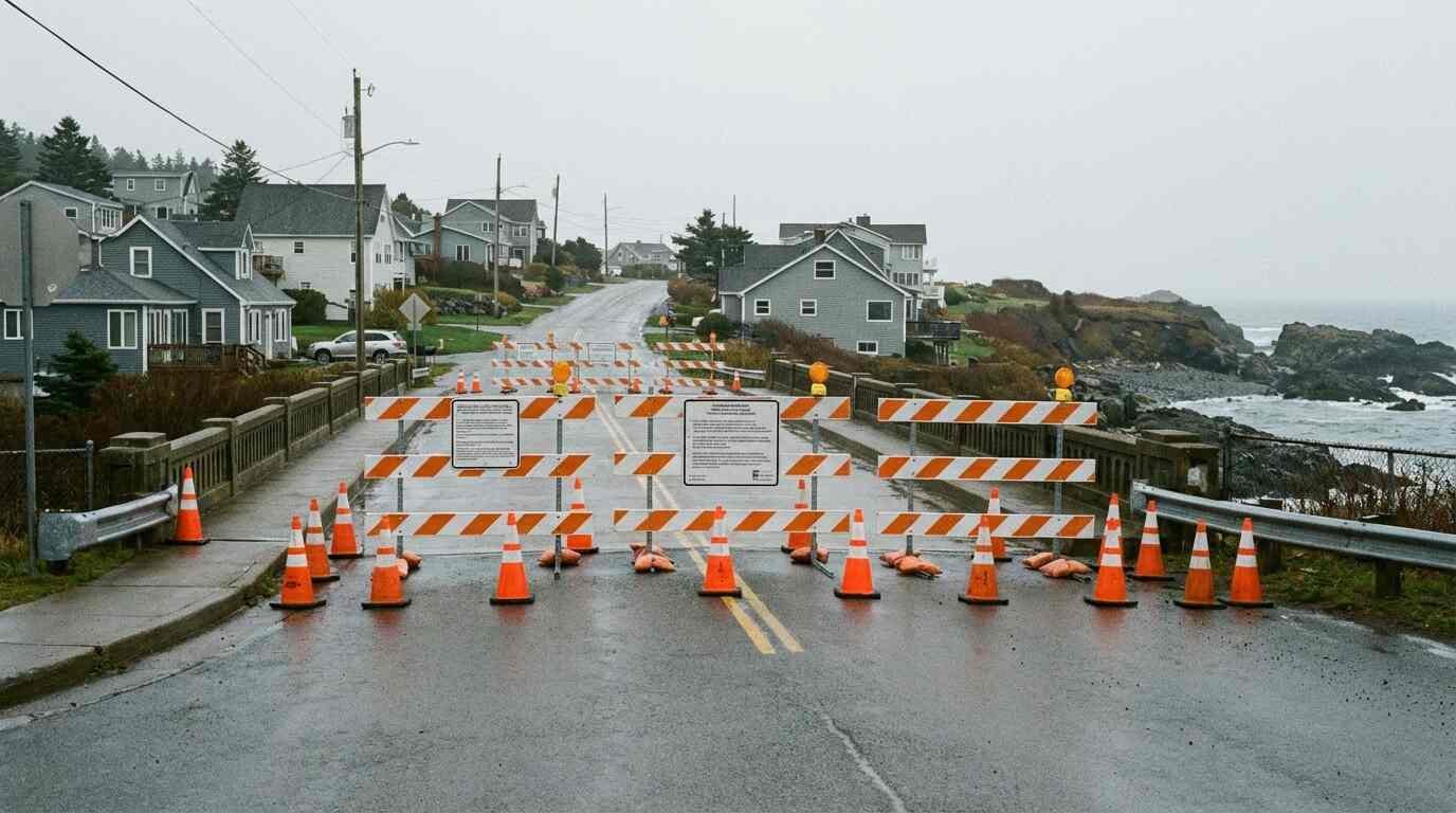
On February 20, 2025, a routine NYSDOT inspection of the Ponquogue Bridge in Hampton Bays found something wrong. Deterioration of a concrete girder. By the next day, the bridge was closed. Not to heavy trucks. Not to emergency vehicles only. To everything — all vehicular and pedestrian traffic, in both directions, until further notice.
Roughly 400 parcels on Dune Road became inaccessible by vehicle. Businesses lost their season before it started. The commercial fishing fleet had to reroute by 5.4 miles. The Hampton Bays Fire Department began coordinating contingency coverage with neighboring departments for a stretch of the fire district it could no longer reach by its normal route. Ambulances required special county permits to cross.
The bridge eventually reopened — first to vehicles under five tons, then working toward restoration of its full 40-ton capacity — but the repair work was ongoing and the questions it raised were not answered by the reopening. What happens next time? What does a permanent repair cost, and who pays for it? What does the long-term future of this structure look like for the people who own property behind it?
Every buyer looking at Dune Road needs to sit with those questions before they write an offer.
One Bridge, One Road, One Way In
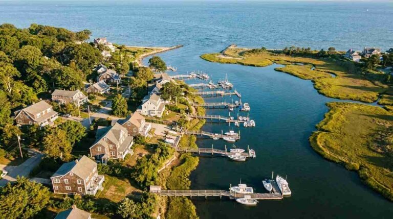
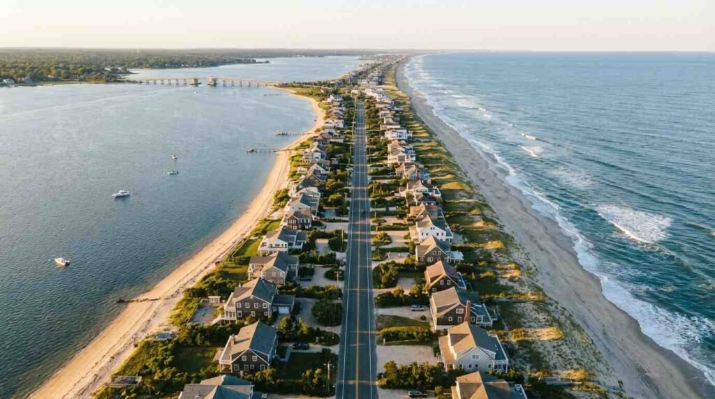
Dune Road runs along the barrier island between Hampton Bays and Westhampton Beach — a narrow strip of sand between Shinnecock Bay and the Atlantic Ocean. The properties on the oceanfront side of Dune Road represent some of the most sought-after real estate on the East End. Oceanfront parcels in this corridor trade at valuations that reflect not just the view but the scarcity: there is only so much barrier island real estate on Long Island’s South Shore, and demand has consistently exceeded supply.
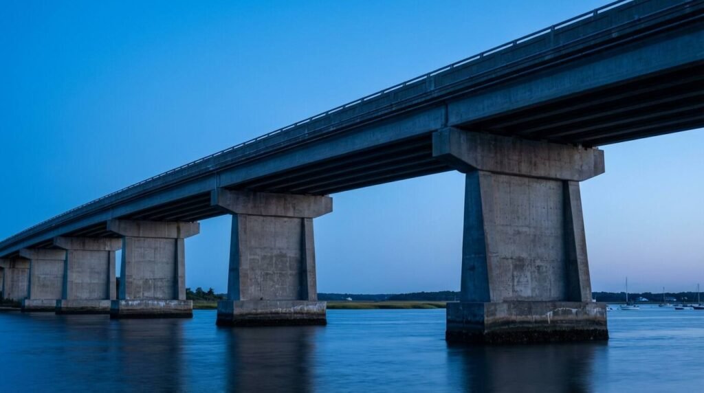
The problem is access. There is one way in for vehicles. The Ponquogue Bridge, which runs 2,812 feet across Shinnecock Bay, connects the Hampton Bays mainland to Dune Road at the Hampton Bays Coast Guard Station. The original bridge on this site was a wooden drawspan, built in the 1930s, that was replaced in 1986 with the current concrete structure. The 1986 bridge cost approximately $14 million. It is maintained by the Suffolk County Department of Public Works. NYSDOT conducts regular inspections.
That 1986 structure is now nearly four decades old. The February 2025 closure was triggered by concrete spalling — the kind of deterioration that is normal in a marine environment but that, in a bridge of this age, indicates that the clock on major intervention has been running.
What the Inspection Record Shows
The February 2025 emergency closure came days after a routine inspection on February 20. The bridge had last been inspected in October 2024. The spalling that triggered the closure was in a concrete girder — a structural element, not a cosmetic surface. Suffolk County Executive Ed Romaine described the bridge as “critically important to emergency services, businesses, and local traffic” when announcing plans for emergency repair. He was not wrong, but the emphasis on importance did not address the question of what condition the bridge was actually in, or how long the current structure can be maintained before replacement becomes the more cost-effective answer.
Buyers should be aware that NYSDOT bridge inspection data is publicly searchable through the state’s bridge inspection database, and that the Federal Highway Administration’s National Bridge Inventory includes condition data for the Ponquogue Bridge. ⚑ Verify: Pull the current sufficiency rating and condition score for the Ponquogue Bridge from the FHWA National Bridge Inventory (searchable at infobridge.fhwa.dot.gov) before publication — the brief indicates the rating has declined steadily and that data should be cited directly.
The relevant question is not whether the bridge was repaired after the 2025 closure — it was — but what the inspection history shows about the trajectory of the structure’s condition over time, and what that trajectory implies about how much life remains before a full replacement becomes unavoidable.
The Replacement Question
Bridge replacement in New York is an exercise in jurisdictional complexity. The Ponquogue Bridge is maintained by Suffolk County DPW but inspected by NYSDOT. Federal highway funds can participate in replacement under certain conditions. Whether a special assessment district could be created to capture value from Dune Road property owners as part of a funding structure is a question that has been raised in civic advocacy circles without resolution.
The 2025 emergency closure surfaced these conversations again. Hampton Bays civic and business organizations have documented their concerns in public communications, and coverage in outlets including Newsday and the Southampton Press has traced the political contours of the replacement debate: what it costs, who has jurisdiction, and who ultimately pays.
For a buyer purchasing a $5 million oceanfront parcel on Dune Road, the bridge replacement question should be part of the underwriting conversation. Not because replacement is imminent — it may not be — but because the timing and funding of that replacement will affect the carrying costs, insurance landscape, and resale dynamics of Dune Road property in ways that are already beginning to be priced into the market by sophisticated buyers and their advisors.
Insurance and Lending Are Paying Attention
The February 2025 closure was not the first time the Ponquogue Bridge created access risk for Dune Road property owners, and the insurance and lending markets have been watching. Barrier island real estate carries inherent access risk regardless of bridge condition — storm closures, drawbridge openings, seasonal traffic — but a closure triggered by structural deterioration is a different category of risk than a seasonal inconvenience.
Insurance carriers writing coastal property policies in this corridor are increasingly attentive to access risk as a factor in coverage terms. Some lenders have begun factoring bridge condition into their underwriting on barrier island properties more explicitly than they did five years ago. This is not yet a universal practice, but the direction is clear: the single-access-point risk on Dune Road is moving from background assumption to underwritten variable.
Buyers should ask their lender directly whether the bridge condition has been flagged in their underwriting. They should also speak with their insurance broker about how access risk is treated in their proposed policy, and whether a bridge closure that makes the property inaccessible by vehicle affects coverage terms or claims treatment.
This is not a reason to walk away from Dune Road. It is a reason to know exactly what you’re buying.
Pricing the Choke Point
The practical question for buyers is how to factor the bridge into their offer strategy without overpaying for risk or overcorrecting and losing a property they genuinely want.
The access risk is real but not unique to Ponquogue Bridge. Every barrier island property on the Atlantic coast faces some version of this. Fire Island, Westhampton Beach, the Rockaways — single-access-point risk is inherent to barrier island geography. What makes the Ponquogue Bridge situation worth specific attention is the combination of the structure’s age, the 2025 emergency closure, and the unresolved replacement question. Those three factors together put this bridge at a different point on the risk curve than a typical barrier island access structure.
My suggestion to buyers seriously considering Dune Road is to do two things before making an offer. First, pull the NYSDOT and FHWA inspection history on the bridge and have an engineer review it. Not a general contractor — a structural engineer who can read a bridge inspection report and tell you what the sufficiency rating trajectory means in practical terms. That’s a few hundred dollars of professional advice that could be worth considerably more in clarity.
Second, ask directly about the replacement timeline. Ask your agent, ask the town, ask the Suffolk County DPW. Put the question on the record. You may not get a satisfying answer, but the act of asking and documenting the responses is valuable due diligence that your attorney should see before closing.
The Ponquogue Bridge is, as Suffolk County’s executive said, critically important. That importance cuts both ways. Important enough that Suffolk County and NYSDOT will act aggressively when the bridge is threatened — as the 2025 emergency response demonstrated. Also important enough that its condition is a variable in the value of every parcel it serves, and buyers should price that variable with the same rigor they’d bring to a flood zone rating or a septic inspection.
The view from Dune Road is extraordinary. The access to that view is a 2,812-foot concrete bridge that is now in its fourth decade of service in a marine environment. Both of those things are true. Buy accordingly.
This is for informational purposes only — consult a licensed attorney and structural engineer for your specific situation.
Real estate markets change. This post reflects conditions as of the publish date. For current listings and market data, contact Pawli at Maison Pawli.
You Might Also Like
– Where Does Your Property Actually End? The Legal Swamp of East End Dock Rights – North Shore Bluff Homes and the Erosion Question: What Buyers Need to Know – The Flood Zone Flip: Why the Cheapest Houses on Long Island’s South Shore Are Suddenly the Most Expensive to Renovate
Sources
– Town of Southampton Emergency Alert — Ponquogue Bridge Closure, February 21, 2025: https://www.southamptontownny.gov/AlertCenter.aspx?AID=PONQUOGUE-BRIDGE-Open-to-Limited-Traffic-237 – East End Beacon — “Update: Ponquogue Bridge Could Reopen to ‘Limited Traffic’ Next Week”: https://www.eastendbeacon.com/ponquogue-bridge-closed-for-inspection-by-engineers/ – Hamptons.com — “Some Answers to the Ponquogue Bridge Situation”: https://hamptons.com/some-answers-to-the-ponquogue-bridge-situation/ – Greater Long Island — “Hampton Bays’ Ponquogue Bridge Will Reopen to Traffic, but With Limits”: https://greaterlongisland.com/hampton-bays-ponquogue-bridge-will-reopen-to-traffic-but-with-limits/ – Patch (Westhampton/Hampton Bays) — Multiple Ponquogue Bridge closure coverage: https://patch.com/new-york/westhampton-hamptonbays/ponquogue-bridge-closed-until-further-notice-hampton-bays – NYSDOT Bridge Inspection Database — searchable at: https://www.dot.ny.gov/main/bridge-data-feeds ⚑ Verify URL is active and that Ponquogue Bridge data is accessible before publication. – FHWA National Bridge Inventory: https://infobridge.fhwa.dot.gov/ ⚑ Pull Ponquogue Bridge sufficiency rating before publication.