The Dune Road That Drowned: How Fire Island’s Original Shore Road Disappeared Beneath the Atlantic
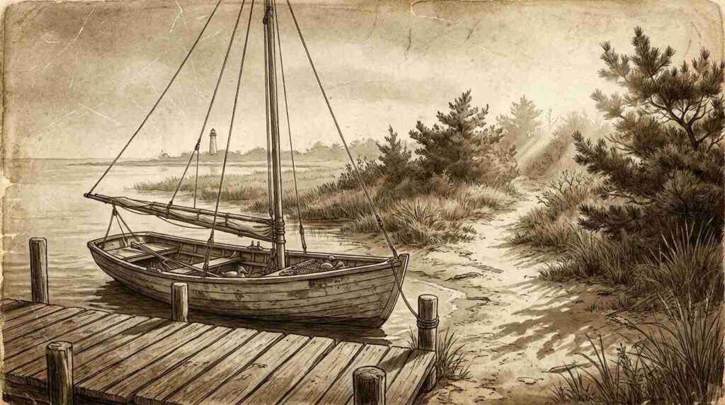
The first time I drove the length of Fire Island on paper — tracing USGS coastal survey maps from 1897 and 1924 spread across a table at the Smithtown library — I kept expecting the road to end. It didn’t. It ran the full length of the island’s bay side, a shell-paved strip connecting fishing camps, hotels, an icehouse at Saltaire, and the communities of Huntington City and Robins Rest, all the way out toward the lighthouse. The baymen who worked it called it simply “the road.” The Atlantic, in a series of storms between 1931 and 1938, called it something else.
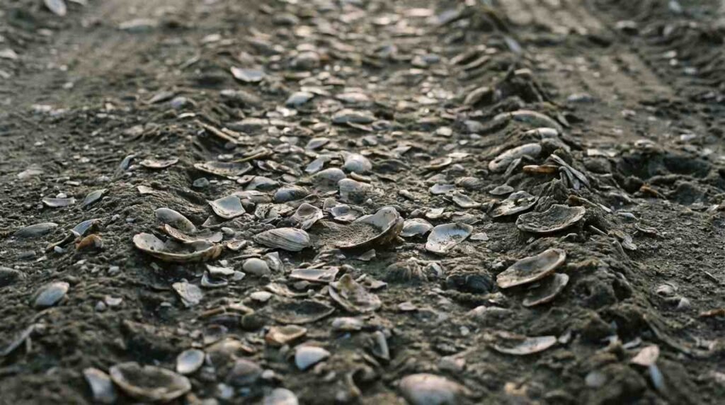
It is gone now. Mostly. On certain low tides, old-timers say you can find the embedded shells still pressed into the bay-side sand near what was the Saltaire approach, as if the road remembers itself. I haven’t confirmed this personally. What I can confirm is that the road existed, that real people traveled it, and that its disappearance tells us something important about what we mean when we say a place is permanent — something I find myself thinking about every time a buyer asks me how close a property is to the water.
A Road That Shouldn’t Have Existed
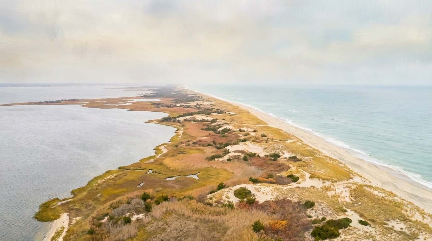
Fire Island is a barrier island. The geology is inherently unstable. A narrow strip of sand and scrub pine, never more than half a mile wide at its widest, sitting between the Great South Bay and the open Atlantic — the island was always in motion, always being subtly remade by wind and tide and littoral drift. The USGS Coastal and Geodetic Survey maps of 1897 document what was already a well-used route along the bay side: a shell-and-packed-sand road that predated any automobile, laid down by the baymen and resort operators who were the island’s first commercial class.
These were not vacationers. They were men who harvested shellfish, ran small hotels, guided fishing parties from the city, and maintained the networks of ferries that crossed the Great South Bay from Bay Shore and Patchogue. The road was their infrastructure — unpaved, seasonal, unlit, and entirely functional. George Maxe, writing in Fire Island: The Unpredictable Shore (1964), described the route as a “corridor of commerce that the mainland didn’t know existed,” used to move ice, provisions, and the occasional injured bayman to the ferry landing at Ocean Beach.
The communities it connected have largely vanished from collective memory. Huntington City — no relation to the North Shore town — was a fishing and resort hamlet on the island’s western section, named with the particular ambition of early developers who believed size would follow if you built the right name. It didn’t. Robins Rest, farther east, was a quieter settlement, occupied by families who spent the shoulder seasons and sometimes wintered over. The Fire Island National Seashore oral history archive holds transcripts of interviews with former residents of both — elderly people in the 1970s and 1980s describing a world of kerosene lamps, fresh flounder, and the sound of the road’s shell surface crackling under wagon wheels in the quiet before summer.
The Light Before Robert Moses
The road existed in what we might call the pre-Moses interval of Fire Island — a period before the Robert Moses Causeway (completed 1954) transformed the island’s western end into the most visited public beach on the East Coast. In that earlier era, access was by ferry, the seasonal population was small, and the culture of the island was shaped entirely by the water: the bay on one side, the ocean on the other, and the fragile strip of sand between.
The 1897 survey shows the route in its fullest extent. By 1924, the next major survey, sections of the eastern approach had already narrowed, the roadbed encroached by tidal action on the bay side. The cartographers noted it without alarm — coastal erosion was understood as a constant, not an emergency. What they didn’t account for was the compound event that would come.
The Storms
Fire Island has always been punctuated by catastrophe. But the 1930s were particularly relentless.
The 1931 nor’easter opened Moriches Inlet on the island’s eastern end, separating Fire Island from Southampton and permanently altering the pattern of littoral drift. Sand that had moved steadily west along the shoreline was now interrupted; the western sections of the island began to starve. The bay-side road, never much more than a shell-paved track at the best of times, began losing coherence at both ends simultaneously.
Then came the Great New England Hurricane of September 1938 — called the Long Island Express by those who lived through it. The storm made landfall at Long Island’s south shore with winds estimated at 120 miles per hour and a storm surge that crossed the full width of the barrier island in minutes. Ocean Beach was devastated. Saltaire lost structures. The icehouse at Saltaire, already struggling by the mid-1930s as mechanical refrigeration reached the island ferries, was finished. And the bay-side road, in its final navigable sections, ceased to exist as a continuous route.
The oral histories in the National Seashore archive are precise about this. One transcript, from a former Robins Rest resident recorded in the 1970s, describes returning to the island the following spring: “The road was just gone. Where it had been, there was just beach. You couldn’t tell.”
The Ghost Geography
What makes the lost road worth considering in 2026 is not the road itself — it was a modest thing, more track than road — but what the road carried. Specifically: the assumption of permanence.
The hotel operators, the icehouse operators, the families who wintered at Robins Rest — all of them made decisions predicated on the idea that the island was a stable place, that the path they had always traveled would continue to be there. This is not a failing of imagination particular to them. It is a human habit, and one that every buyer of waterfront property on Long Island’s south shore contends with in some form today.
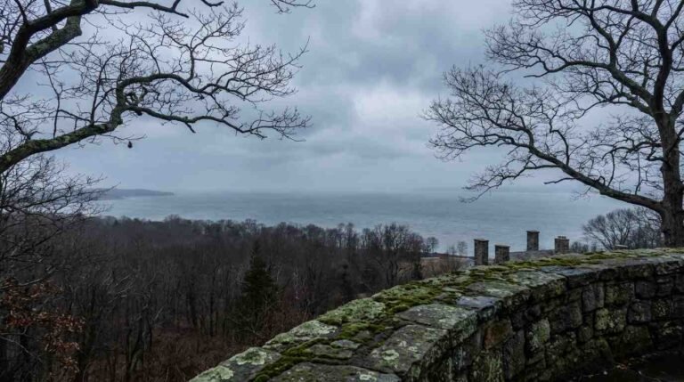
I’m not making a comparison to frighten anyone. The bluff homes and waterfront properties I work with on the North Shore are on a fundamentally different geological footing than a barrier island — the Sound behaves differently than the Atlantic, the properties sit differently in relation to the water, and the erosion calculus is not the same. But the erosion question that North Shore bluff buyers face is related to the same underlying truth: the relationship between land and water is never static.
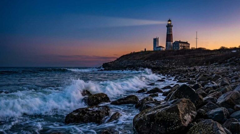
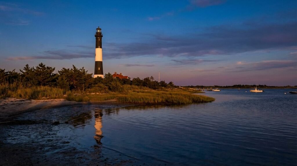
The Fire Island Lighthouse, which the road once helped provision, still stands. It’s a beautiful thing — the black-banded tower visible from miles at sea, the keeper’s quarters now a museum. The communities the road served are more complicated. Huntington City is gone. Robins Rest persists as a small hamlet of about forty houses, accessible now by the Burma Road — a sand path through Federal Seashore wilderness — and by ferry. The road that once connected it to the rest of the island survives only in the USGS maps, and in the shells that show themselves at low tide.
What October Knows
I’ve been to Fire Island in late October, which is the only time to see the island as the baymen knew it. The summer people are gone. The concession stands are shuttered. The dunes go pale gold, a color that is not quite sand and not quite hay but something between the two, and the light from the southwest in late afternoon has a particular quality — flat, marine, very old. The National Park Service maintains a history and culture page for Fire Island National Seashore that offers a starting point for the documentary record; the Koppelman and Forman institutional history is the most thorough account of what the park preserved and what it lost.
The road is not on any of the interpretive signs at the National Seashore. It doesn’t need to be — it’s not a story of what the park preserved, it’s a story of what the ocean claimed before anyone thought to preserve it. The baymen who traveled it were not historical figures to themselves. They were working men, moving ice and provisions, checking their boats, doing what the island required. The road they built was practical, perishable, and briefly permanent. It lasted exactly as long as the sand allowed.
Which is to say: not forever, but long enough.
Real estate markets change. This post reflects conditions as of April 2026. For current listings and market data, contact Pawli at Maison Pawli.
You Might Also Like
- North Shore Bluff Homes and the Erosion Question: What Buyers Need to Know
- Holding Back the Sound: The Brutal Economics of North Shore Bulkheads
- Riven or Sawn: The Chestnut Question in the Fire Island Life-Saving Stations and What the Planks Remember
Sources
- USGS Coastal and Geodetic Survey maps, 1897 and 1924 — NOAA Historical Map & Chart Collection
- Fire Island National Seashore History & Culture — NPS
- Lee E. Koppelman and Seth Forman, The Fire Island National Seashore: A History, SUNY Press, 2008
- George Maxe, Fire Island: The Unpredictable Shore (1964)
- Ocean Beach Historical Society — villageofoceanbeach.org
- Fire Island Association — Robbins Rest community profile