The Silk Road Still Has Edges: Traveling the Wakhan Corridor by Permit
The Gorno-Badakhshan Autonomous Region (GBAO) permit is issued by Tajikistan’s Ministry of Foreign Affairs. It is a standard document, available through the application process for a Tajik visa or as a supplementary permit for travelers already holding a Tajik visa, and it is the legal authorization required to enter the eastern portion of Tajikistan that borders Afghanistan, China, and Kyrgyzstan — including the Tajik side of the Wakhan Corridor.
Almost no one applies for it. This is partly unfamiliarity, partly proximity to Afghanistan, and partly because the infrastructure in the Wakhan does not announce itself. There are no direct flights. The road from Dushanbe to Khorog, the regional capital of GBAO, is paved in sections and not in others. The journey takes between twelve and eighteen hours depending on conditions. From Khorog, the Wakhan begins.
The Permit Process
The GBAO permit can be obtained through Tajikistan’s e-visa system at the time of visa application. Travelers who apply for a Tajik visa without the GBAO supplement and later decide to enter the region must obtain a separate permit, either through the Ministry of Foreign Affairs office in Dushanbe or, in some documented cases, through the regional administration in Khorog — though the latter pathway is less reliable and varies by period.
Caravanistan, a research and documentation site used by journalists, academics, and regional travelers, maintains the most accurate and current documentation of permit procedures for Central Asia, updated as conditions change. The GBAO permit process is covered in detail there, including updates on e-visa integration and any temporary permit suspensions, which have occurred historically in periods of regional political tension.
The permit itself does not specify individual destinations within GBAO. It authorizes presence in the region. Movement within GBAO toward the Ishkashim border crossing — the crossing between Tajikistan and Afghanistan that opens briefly for a weekly bazaar, one of the few legal points of interaction between the two countries in the corridor — requires no additional permit for the Tajik side but should be approached with current information, as operational status has varied.
The Panj River
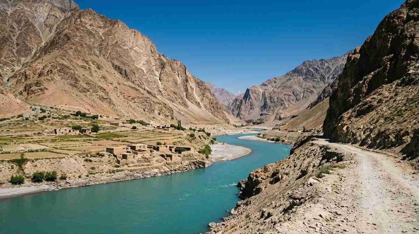
The Panj River forms the border between Tajikistan and Afghanistan along the Wakhan corridor. The road on the Tajik side follows the river for several hundred kilometers. On the far bank, Afghanistan.
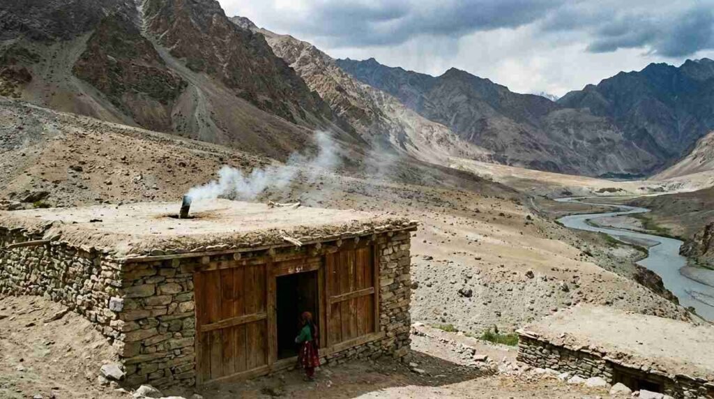
The landscape along the Panj is structurally unchanged from the Silk Road’s operational peak — not metaphorically, but geographically. The river valley narrows in places to a width where you can observe the opposite bank without optical aid. The Afghan Wakhan is unindustrialized; the settlements visible across the water are mud-brick and animal-pen and smoke. The Tajik side has a road. That is the significant infrastructure difference.
The Aga Khan Development Network has been active in GBAO and the Afghan Wakhan since the 1990s, funding road construction, schools, and health infrastructure on both sides of the corridor. Their published regional reports document the communities of the Wakhan in more detail than most international sources — the Wakhi people who have lived in the corridor continuously, the Kyrgyz nomads in the Afghan Pamir to the east, the seasonal migration patterns that persist. The AKDN’s work is the most reliable published documentation of the region’s human geography available in English.
What the Corridor Reveals About Silk Road Geography
The Wakhan Corridor — the narrow strip of Afghan territory that extends eastward to China, bordered by Tajikistan to the north and Pakistan to the south — exists as a geopolitical feature because of the Great Game: British and Russian imperial negotiators in the late nineteenth century agreed that a buffer strip of territory between their respective spheres of influence would prevent direct border contact. The width of the Afghan Wakhan at some points is approximately fifteen kilometers.
That history is not incidental to what the corridor looks and feels like today. The inaccessibility that made it useful as a buffer also preserved it. There is no extraction industry along the Panj because the terrain prohibited development during every period when development was happening elsewhere. There is no legacy industrial infrastructure because the corridor was never industrialized. The result is a landscape that is centuries-old not by design but by neglect of the logistical conditions that produce change.
Traveling the Tajik Wakhan is not a historical recreation. It is an observation of what landscape looks like when modernity has been effectively absent. The road exists; the Soviet-era presence left some structures. But the river valley, the grazing patterns on the Afghan side, the relationship of settlement to water and defensibility — these read as old in a way that almost no landscape in Europe or North America does.
Logistics That Matter
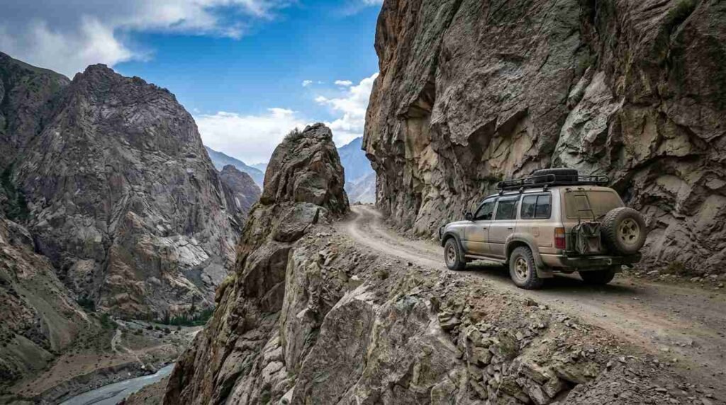
The road from Khorog to Ishkashim and onward toward Langar — the last village before the Afghan Pamir — is passable in summer and early autumn by 4WD vehicle. It is not reliably passable in winter. Hiring a driver in Khorog with Wakhan experience is not optional. The road has sections where mobile coverage is absent for hours, the fuel supply is intermittent outside of Khorog, and the medical infrastructure between Khorog and the Chinese border is minimal.
Lonely Planet’s Central Asia guide provides verified regional coverage including Khorog logistics, guesthouse availability along the corridor, and the Ishkashim bazaar schedule. This is a region where printed and downloaded information is more reliable than real-time digital search, because connectivity is not consistent.
The permit is the easy part. The logistics require preparation. The result is access to a landscape that most travelers to Central Asia never reach and that is structurally different from any other travel experience I have had — not more dramatic, but more quiet. The quietness is the point.