The Stroad That Ate Jericho Turnpike: How One Road Fragmented Five North Shore Communities
There’s a moment, driving west on Route 25 through Woodbury, when you realize you’ve lost the town. You passed through it — technically — but there was no there there. A gas station, a nail salon behind a parking apron, the back end of a strip plaza facing the wrong direction. You keep driving, and by the time the road narrows again past Cold Spring Harbor, you’re left with the vague feeling that something was supposed to be there, and isn’t.
That feeling has a name. Urban planners call it a stroad — a portmanteau of “street” and “road” — and Jericho Turnpike is one of the most clarifying examples on Long Island. Too fast to support the sidewalk life of a real street. Too slow and stop-signed to function as efficient road. A road that promises to get you somewhere quickly and fails at that, too, while dismantling everything interesting that once existed along its edges.
I’ve sold homes within a quarter mile of Route 25 in four different towns. I’ve watched what the road does to value, to street life, to the basic logic of a neighborhood. And I’ve come to think that understanding what happened to Jericho Turnpike — specifically, the postwar decisions that made it what it is — is essential to understanding why some North Shore communities have held together and others haven’t.
The Road Before the Road
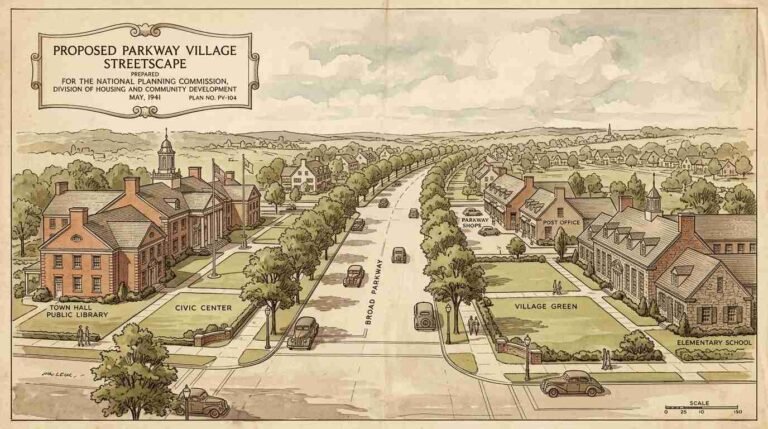
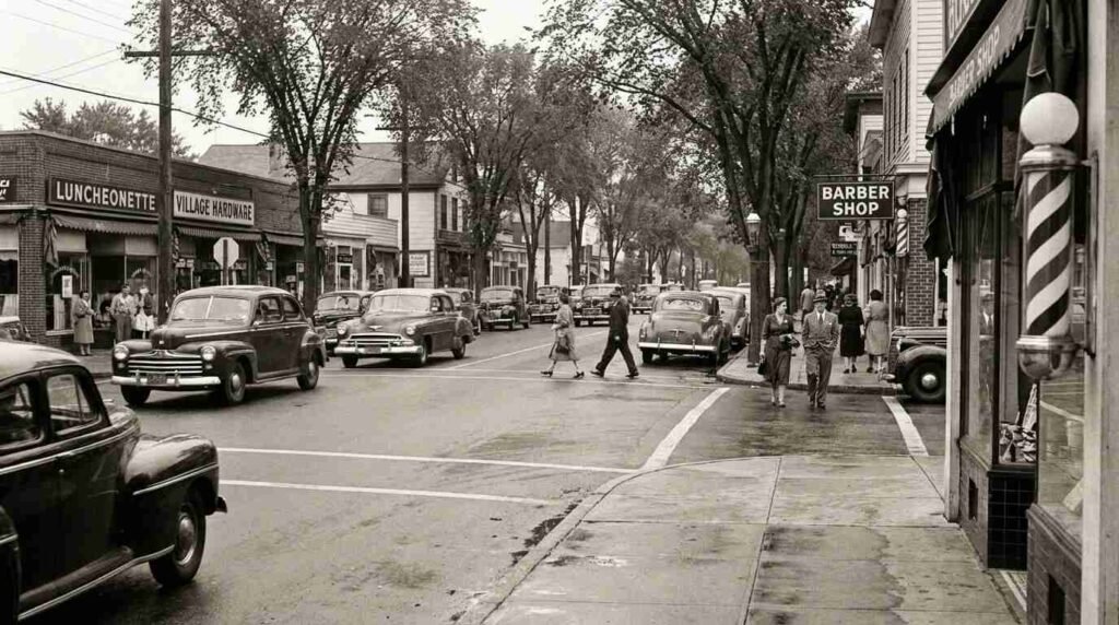
Jericho Turnpike has been a through-route since the colonial era. The name comes from the Jericho plank road, chartered in 1801, which connected Jamaica to Jericho along a path that indigenous people had used long before European settlement. By the early twentieth century, the road passed through a succession of genuine village centers — Mineola, Westbury, Syosset, Woodbury, Cold Spring Harbor, Huntington Station — each with its own commercial core, its own pedestrian rhythm, its own reason to stop.
Sanborn fire insurance maps from the 1920s and 1930s, held in the Library of Congress digital collection, show the storefront density along the corridor that has since been erased: hardware stores, pharmacies, bakeries, barbershops, the kind of mixed-use ground floors that Jane Jacobs would later describe as the basic unit of urban life. The sidewalks were narrow by today’s standards, but they were continuous. The road itself was two lanes in most stretches. People walked across it.
The Huntington Town Historian’s office holds engineering correspondence from the 1950s that tells the next part of the story. Postwar traffic studies commissioned by Nassau and Suffolk counties projected dramatic increases in automobile volume along the Route 25 corridor, and the recommended response was consistent: widen the road. Add lanes. Redesign intersections for higher vehicle throughput. The logic was internally coherent — more cars were coming, and the road needed to accommodate them. What the studies did not model was what widening would do to the communities the road passed through.
The Border Vacuum Arrives
Jane Jacobs introduced the concept of the “border vacuum” in The Death and Life of Great American Cities (1961) — a book published, with painful timing, just as Long Island’s postwar road-widening program was hitting its stride. A border vacuum is what happens when a large, single-use element — a highway, a rail yard, a park without active edges — creates a dead zone on either side. The border itself generates so little foot traffic, so little reason to linger, that the blocks adjacent to it atrophy. Storefronts empty. Residents stop walking to the commercial district because the crossing feels hostile. The social spine of the neighborhood becomes a wall.
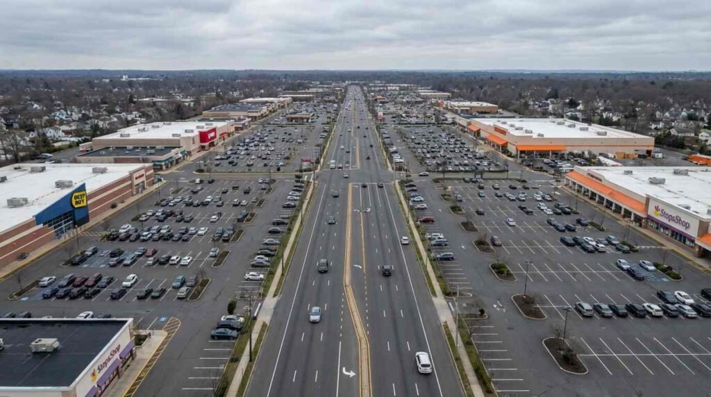
Route 25 through Syosset is a textbook case. Before the lane additions and signal retimings of the 1960s, the stretch of Jericho Turnpike through the Syosset hamlet had a recognizable downtown character — a small cluster of Main Street-adjacent businesses, a railroad station within walking distance, a sidewalk that connected things. By 1975, that character had been substantially erased. The road had been widened to accommodate five travel lanes in peak segments, turn pockets added at major intersections, curb cuts proliferated as businesses rebuilt facing the road rather than the pedestrian realm.
The Newsday archive at the Huntington Public Library documents business closures along the corridor through the 1960s and 1970s — not as a connected story about road design, but as isolated items: a hardware store closing after forty years, a diner relocating, a pharmacy selling to a chain. Individually, each item reads as ordinary commercial churn. Assembled, they trace the withdrawal of the pedestrian economy from both sides of the road.
What the Numbers Show Now
The NYSDOT pedestrian safety data portal tracks injury and fatality rates by road segment. Route 25 through Nassau and western Suffolk counties registers among the most dangerous pedestrian corridors in the region — not surprising, given the design, but worth stating plainly.
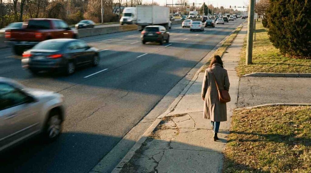
A road designed to move cars at arterial speeds, with multiple unprotected crossing points, with driveways that interrupt any continuous sidewalk, produces a specific kind of danger. Pedestrians don’t stop walking because they decide to stop; they stop walking because the infrastructure makes walking feel — and eventually become — genuinely hazardous. And once pedestrian volume drops below a threshold, the commercial case for ground-floor retail evaporates. The stores that remain orient to drive-by traffic. The ones that leave are replaced by uses that don’t need foot traffic at all: storage facilities, auto-related services, the back ends of big-box parking lots.
What this creates on either side of the road is a residential neighborhood that is physically separated from its commercial district by a crossing that feels dangerous, and a commercial district that has reorganized itself entirely around the automobile. The residents on the north side of Route 25 in Woodbury are not walking to the CVS on the south side, not because they don’t want to, but because the road has made that walk feel like a reasonable thing to avoid.
Cold Spring Harbor Held On — And Why
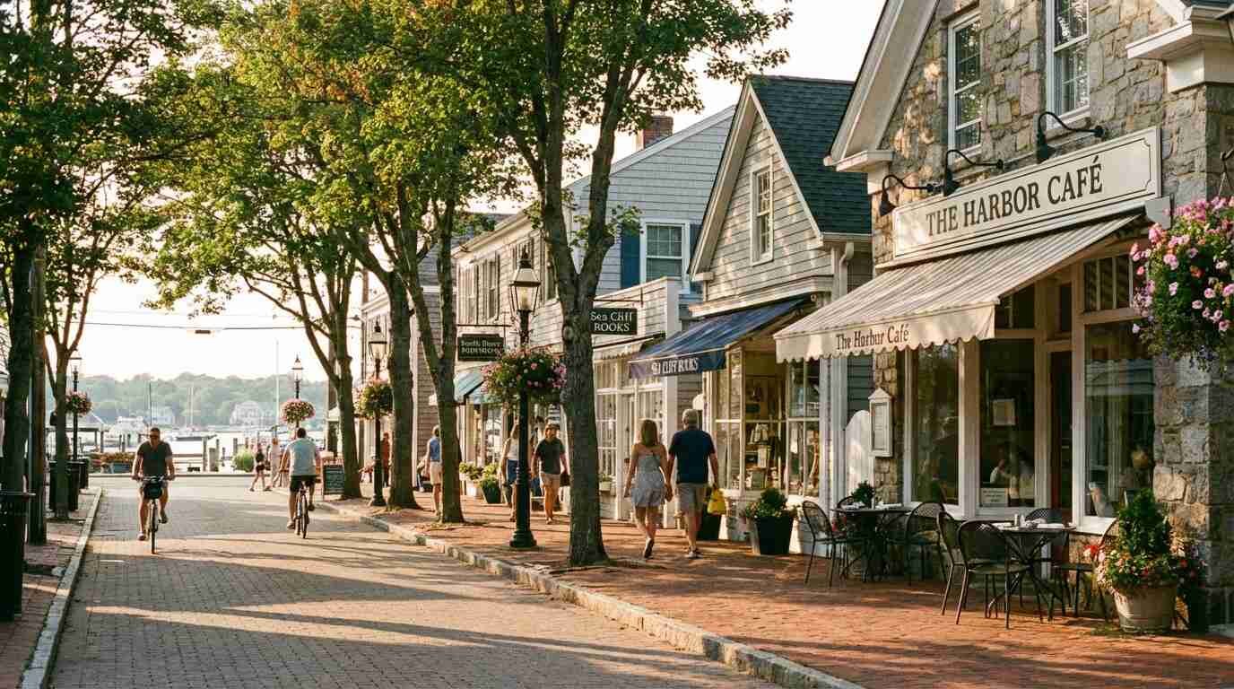
Not every community along the corridor lost the same amount. Cold Spring Harbor is the clearest counter-example, and it’s instructive.
The village center at Cold Spring Harbor sits slightly off Route 25, accessed by a deceleration into the actual village fabric. The road narrows. There are trees. The scale of the built environment shifts. And critically, the zoning held. Cold Spring Harbor’s village commercial district was not fully suburbanized in the 1960s and 1970s — the combination of historic character, a relatively protected village designation, and the orientation of the commercial blocks away from the arterial road preserved enough of the pedestrian logic to keep the street functioning as a street rather than as a service corridor for drive-by traffic.
The result, today, is legible: Cold Spring Harbor has a walkable village center. Cold Spring Harbor has restaurants and boutiques that survive on foot traffic. Cold Spring Harbor has real estate premiums that reflect, among other things, the quality of the pedestrian environment.
This is not an accident of geography or charm. It is the direct consequence of planning decisions, some deliberate and some simply the result of inertia preserving what the road-widening didn’t reach.
Huntington Station and the Unfinished Story
Huntington Station is the most complicated case on the corridor, and the one I find myself returning to most often. The road through Huntington Station is wide — five lanes for much of its run, with the kind of intersection geometry that was designed in an era when the pedestrian was not part of the calculation. The south side of the road runs past a transit hub — the Huntington LIRR station — that should, by every logic of walkable urbanism, anchor a thriving commercial district. It doesn’t, not in the way it could.
What exists instead is a community in the process of figuring out what it wants to be. There are new apartment buildings near the station. There are community development efforts, some of them serious, aimed at creating the kind of mixed-use density that would allow the station area to function as a real downtown rather than a transit stop surrounded by arterial spillage. Whether those efforts succeed will depend, in part, on whether the county and town are willing to address the road itself — not just the buildings beside it, but the number of lanes, the signal timing, the crossing distances that currently make the walk from the platform to a cup of coffee feel like a negotiation with traffic.
I’ve had conversations with buyers who looked at Huntington Station specifically because of the transit access, specifically because they wanted to live without a second car. Almost to a person, they struggled with the pedestrian environment. The bones are there. The LIRR connection is real. But the road is the obstacle.
What This Means If You’re Buying Near Route 25
I don’t tell clients to avoid Route 25 communities. Some of the best homes I’ve ever shown are a short drive — note the qualifier — from the corridor. But walkability is a real variable in both quality of life and long-term property value, and it’s worth being honest about what the road does and doesn’t offer.
The communities that have held onto village-scale pedestrian environments — Cold Spring Harbor most notably — carry premiums that reflect that character. The communities where the road has fully suburbanized the commercial edges have a different profile: lower entry prices in many cases, car-dependent daily life, and a value proposition that depends more on school district and lot size than on neighborhood walkability.
Neither profile is wrong. But buyers should go in with clear eyes about which they’re choosing. The stroad doesn’t announce itself in a listing description. It shows up in your life every time you need a gallon of milk.
What I tell people is this: before you make an offer on anything near Route 25, spend a Saturday morning walking from the house to wherever you’d actually want to walk. See what the crossing feels like. Count how long the light cycle runs. Note whether there’s a continuous sidewalk or whether you’re stepping around a driveway cut every forty feet. The road is part of the house. It always has been.
Real estate markets change. For current listings and market data, contact Pawli at Maison Pawli.
You Might Also Like:
- The Lock-In Effect: Why North Shore Inventory Is So Tight Right Now
- The Covenant in the Deed: How Restrictive Covenants Shaped Long Island Neighborhoods
- Holding Back the Sound: The Brutal Economics of North Shore Bulkheads
Sources:
- Jacobs, Jane. The Death and Life of Great American Cities. Random House, 1961.
- Sanborn Fire Insurance Maps — Long Island, 1920s–1940s. Library of Congress Digital Collections. https://www.loc.gov/collections/sanborn-maps/
- Nassau County Department of Public Works historical engineering files — verify access through Nassau County Museum research library
- Huntington Town Historian’s Office, Huntington, NY — road-widening correspondence, 1950s–1960s
- Newsday archive — Huntington Public Library, Long Island Room
- NYSDOT Pedestrian Safety Data Portal — https://www.dot.ny.gov/programs/safety/ped-bike-safety