The Harbor That Shaped the Parcel: How Port Jefferson’s Victorian Commercial Block Survived Where Others Didn’t
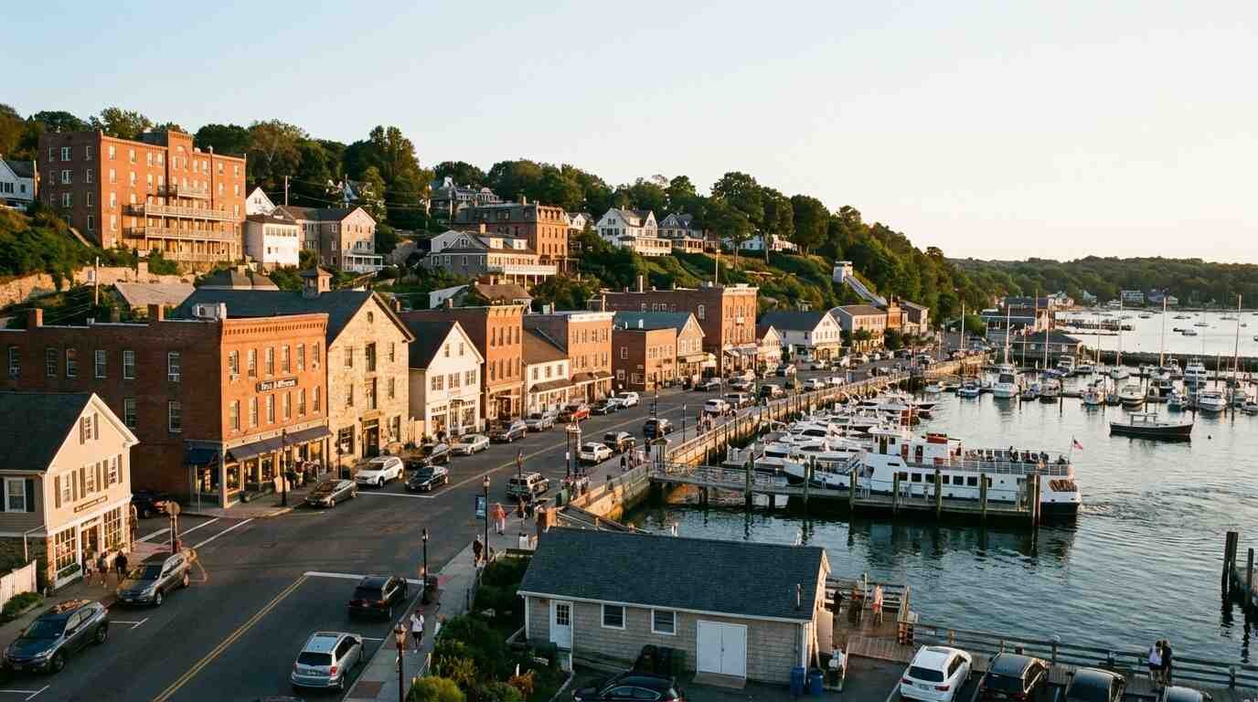
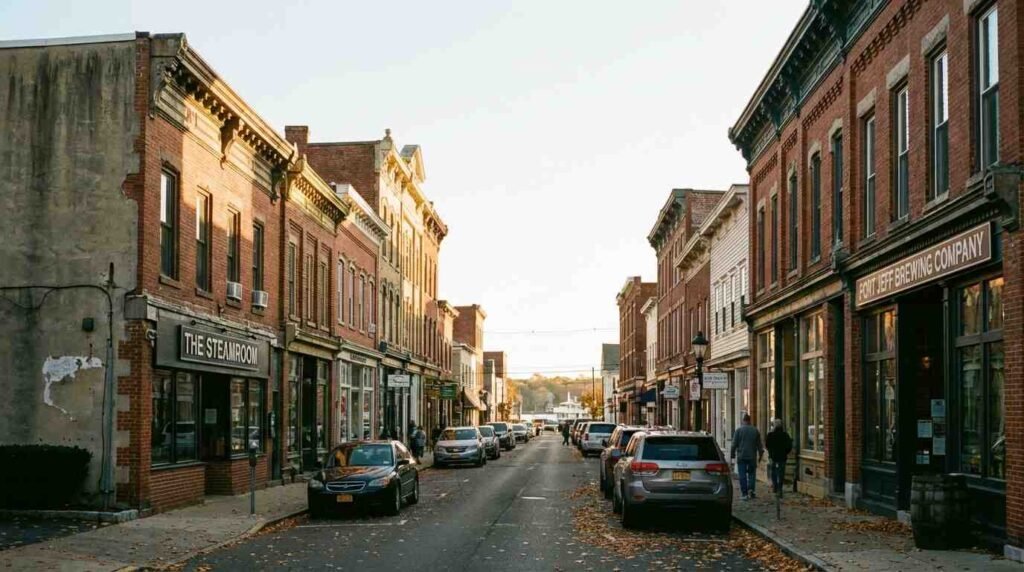
There is a particular quality of light on East Main Street in Port Jefferson on a late October afternoon, when the sun drops low enough to catch the face of the brick at an angle. The masonry reads differently then — you can see the texture of individual courses, the slight variations in color where different firing temperatures produced different results, the ghost shadow of a cornice bracket removed sometime in the mid-twentieth century and never replaced. I have walked this block in every season and at every hour, and I have come to think of it less as a commercial street and more as a document — one that most Long Island villages no longer possess, because theirs was demolished or sheathed or simplified into oblivion long ago.
Port Jefferson’s East Main Street commercial corridor is one of the few surviving examples on the North Shore of a Victorian-era masonry retail block that remains substantially intact in its original massing, materials, and relationship to the street. The Port Jefferson Village Historic District, listed on the National Register of Historic Places in 2005, encompasses nearly 100 buildings, the majority constructed between 1840 and 1870 in Greek Revival, Italianate, and Victorian styles. But the commercial block on East Main — the narrow street that drops from the upper village toward the harbor — is something different in register from the domestic architecture that dominates the district. It is professional architecture, built to project stability and permanence to customers and creditors alike, and the structural and material decisions embedded in it are a direct record of the economy that produced them.

The Shipbuilding Ledger, Written in Brick
The shipbuilding industry that made Port Jefferson prosperous in the mid-nineteenth century was, above all, a credit economy. The Bayles, Mather, Hawkins, and Darling yards — which together made Port Jefferson the leading shipbuilding center in Suffolk County, responsible for roughly forty percent of the county’s total production — required continuous capital: for timber contracts, for cordage and canvas, for the wages of skilled joiners and caulkers and riggers who moved between yards as work demanded. The merchants and provisioners who served that economy needed buildings that communicated the same permanence and creditworthiness that their customers required of them.
Brick was the material of that communication. The Sanborn fire insurance maps of Port Jefferson — the detailed, large-scale surveys prepared by the Sanborn Map Company, now accessible through the Library of Congress — record a commercial corridor whose buildings were overwhelmingly masonry construction at a time when most of the residential stock on the surrounding hills remained wood-framed. This is not incidental. Brick was more expensive to build and more expensive to insure; its presence signaled a commitment to place and a calculation about permanence that wood construction did not. The merchants on East Main were not speculating. They were building in a material that said they intended to stay.
The brick coursing on several of the surviving buildings follows a Flemish bond pattern — alternating headers and stretchers on the same course — that was already considered somewhat old-fashioned by the 1870s, when English bond had become more common in commercial construction elsewhere. Its persistence in Port Jefferson suggests either conservative local practice or, more probably, a deliberate aesthetic choice: Flemish bond reads as more formal, more precise, more finished than the utilitarian English bond that surrounded it in merchant districts building faster and thinking less carefully about surface. A building on East Main is trying to look like something.
The Corner Bank and What It Reveals
The most architecturally considered building on this corridor is the First National Bank of Port Jefferson, built in 1900 at the corner of Main Street and East Main — a date that places it at the exact moment when the shipbuilding economy was beginning its long contraction, when the last significant yards were still operational but the writing was visible on the harbor wall. The building is two and a half stories of brick with a two-story turret that projects from the southwest corner, rising above the roofline with a steeply pitched cone-shaped slate roof and three windows on each level. The turret is the key to understanding the building’s program: it addresses two streets simultaneously, anchoring the corner with a three-dimensional element that makes the building legible from multiple approaches.
This is sophisticated commercial urbanism for a village of Port Jefferson’s scale in 1900. The architect understood that the corner parcel is a different civic problem than the mid-block storefront — it has an obligation to the intersection, to the pedestrian experience of approach, to the skyline as read from the harbor. The turret solves that problem with a confidence that suggests either a designer who had studied precedents in the larger masonry tradition or a client sophisticated enough to demand them. The building was added to the National Register of Historic Places separately from the village district, in 2005 — recognition that it represents something beyond the aggregate architectural record, a singular moment of civic ambition in brick and slate.
The fenestration pattern on the upper floors — double-hung windows with segmental arched heads, arranged in a rhythm that is consistent across the principal facade without being mechanical — is the other detail that repays close attention. Each window opening is framed by slightly projecting brick surrounds that read as subtle molding against the plane of the wall. This is the kind of ornamental restraint that characterizes the better commercial architecture of the period: it acknowledges the wall as a surface to be composed, not merely as a structural necessity to be punched through wherever light was needed.
Geology as Preservation Policy
The reason these buildings survived — the reason Port Jefferson’s commercial corridor did not suffer the wholesale mid-century demolition that erased equivalent masonry blocks in Northport, Amityville, and much of the South Shore — is as much geological as it is historical.
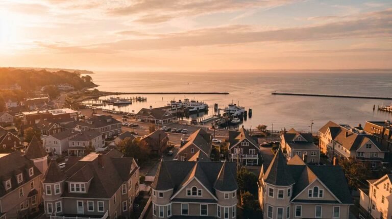
Port Jefferson is a topographically constrained site. The village is divided between Upper Port and Lower Port, with East Main Street navigating the transition between them: the harbor at one end, the railroad station and its elevated grade at the other. The hills on which the residential neighborhoods sit are glacial moraines, steep enough to limit the kind of suburban commercial redevelopment that transformed flatter Long Island communities in the postwar decades. The parcels on East Main are small, irregular, and bounded by grades that made assembly for large-scale redevelopment expensive and logistically complicated. A developer who might have been interested in replacing a Victorian masonry block with a single-story strip center in 1968 had to reckon with the fact that the topography made site engineering difficult and that the resulting building, on a hillside block of limited depth, would have been commercially inferior to what was already there.
This is not the preservation story that historical societies prefer to tell — the one about stewardship and community care and the conscious decision to save something valuable. In Port Jefferson, the masonry block survived in part because demolishing it and building something new was hard. The harbor that shaped the parcel in the nineteenth century, by constraining the grade and dictating the lot geometry, inadvertently protected what was built on it a century later by making redevelopment economically unattractive. Architecture has its accidents, and they are sometimes very beautiful ones.
What the Buildings Know About the Economy
Walking East Main today with the Sanborn maps in mind is an exercise in reading economic history through material evidence. The commercial buildings that survive are disproportionately those that served the durable needs of the village economy — banking, provisioning, professional services — rather than the more volatile retail categories that turned over faster and remodeled more aggressively. A building that served a bank in 1900 was still serving some version of institutional or professional occupancy in 1950; a building that served a dry goods merchant in 1880 was more likely to have been stripped and simplified in the intervening decades as retail fashions changed.
The Mather family’s presence runs through this history at multiple registers. The Mather House — built between 1840 and 1860 for the shipbuilding family, now the center of the Historical Society of Greater Port Jefferson museum complex — anchors the residential side of the equation. The Society’s archives hold ship logs, deeds, correspondence, and photographs that document the yards and the commerce that surrounded them, including paintings by William Davis depicting the Bayles and Willse operations on the harbor. These images, read alongside the Sanborn maps, allow something like a reconstruction of the spatial relationship between the commercial corridor and the yards — the merchants on East Main were literally selling to the workers and suppliers who could be seen from the upper windows of those buildings, loading and fitting out vessels in the harbor below.
The Bayles Chandlery — an 1897 building separately listed on the National Register, part of the Bayles Shipyard complex — is the other surviving anchor of this material record. Its 1917 Machine Shop and Mould Loft represents a different register of industrial architecture from the commercial brick of East Main, but the two building types were functionally intertwined: the chandlery supplied what the merchants ordered, and the merchants extended the credit that the yards required to operate between contract deliveries.
Pawli’s Take
What I find myself telling buyers when Port Jefferson comes up — and it comes up often, because the village has a magnetism genuinely unusual on the North Shore — is that the built environment there is making an argument that most Long Island communities lost the capacity to make a long time ago. The argument is about permanence. It is about the decision to build in a material that assumes the building will be standing in a hundred years, and the decision of subsequent generations to leave it standing rather than replace it with something cheaper and flatter and more convenient.
That argument has direct market implications. In the Historic District, properties with intact Victorian-era commercial or residential fabric consistently command premiums that reflect not just the intrinsic quality of the construction but the rarity of what survives. When I look at a masonry commercial block on East Main and think about what it would cost to reproduce it today — the brick, the slate, the corbeled cornice, the fenestration detail — I understand immediately why preservation easements have value far beyond their face amount. You are not protecting a building. You are protecting a material argument about what a place is and what it intends to remain.
Port Jefferson’s recent market dynamics are inseparable from this architectural legacy. The village’s ferry terminal connection to Bridgeport and its LIRR terminus make it uniquely accessible for a North Shore community of its scale — but access alone does not create the kind of buyer desire that Port Jefferson generates. That desire is produced by what you see when you arrive: a commercial street where the nineteenth century is still structurally present, where brick and slate make the case that some decisions were made for longer than a generation.
Real estate markets change. For current listings and market data, contact Pawli at Maison Pawli.
Sources
– Port Jefferson Village Historic District, National Register of Historic Places (NPS, 2005): https://www.nps.gov/nr/ – First National Bank of Port Jefferson, Wikipedia: https://en.wikipedia.org/wiki/First_National_Bank_of_Port_Jefferson – Bayles Shipyard, Wikipedia: https://en.wikipedia.org/wiki/Bayles_Shipyard – Bayles Shipyard production records, ShipbuildingHistory.com: http://shipbuildinghistory.com/shipyards/19thcentury/bayles.htm – “Delivered Afloat in the Harbor,” Harborfront Park Historical Marker (Incorporated Village of Port Jefferson, 2008): https://www.hmdb.org/m.asp?m=114740 – The Historical Society of Greater Port Jefferson: https://www.gothamcenter.org/long-island-archives-2/the-historical-society-of-greater-port-jefferson – Sanborn Fire Insurance Maps (Library of Congress): https://www.loc.gov/collections/sanborn-maps/ – Port Jefferson, New York, Wikipedia: https://en.wikipedia.org/wiki/Port_Jefferson,_NY