The Hampton Bays Marina That Became a Cold War Listening Post — and the Waterfront Parcels That Still Show Up Strange on Deed Searches
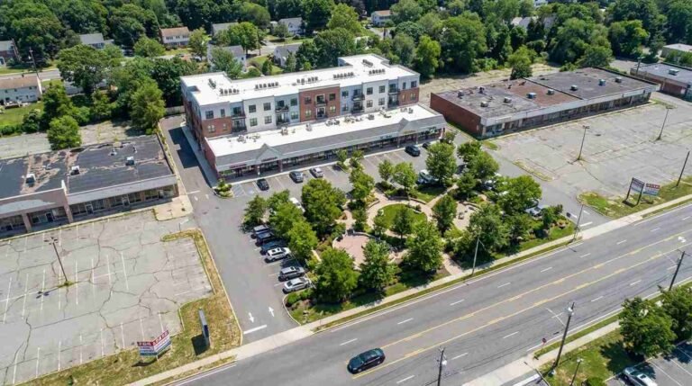
Most waterfront buyers in Hampton Bays are thinking about what they can see: the view, the access, the setback from the water. What they are rarely thinking about is what happened on that land before the current owners, or the owners before them — and whether that history left a mark that still shows up in the paperwork today.
I’ve been selling on the East End long enough to know that the most interesting title anomalies aren’t the obvious ones. A shared driveway easement, an old agricultural covenant, a neighbor who reserved mineral rights in 1962 — those get flagged quickly and resolved the same day. What doesn’t get resolved quickly, and often doesn’t get explained at all, are the federal conveyances. The entries in a deed chain where the grantor isn’t a family name or a development company but a branch of the United States government. Those entries sit in the Suffolk County Clerk’s records and title companies note them and move on, because they’re legitimate transfers — the federal government selling land it once needed. But buyers almost never get the full story of why the federal government held those parcels in the first place.
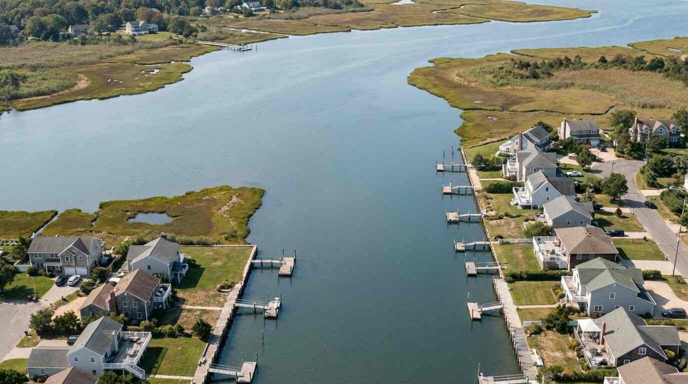
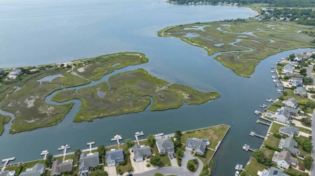
In Hampton Bays, particularly in the areas around Tiana Bay and the Shinnecock Canal corridor, some of that story involves one of the most classified infrastructure programs of the Cold War.
Listening to the Ocean
The Sound Surveillance System — SOSUS — was the Navy’s answer to a problem that became urgent in the early 1950s: Soviet submarine fleets were expanding, they were getting quieter, and the United States needed a way to track them across vast stretches of ocean without being detected in return. The solution was elegant in concept and staggering in scale. Arrays of hydrophones were placed on the ocean floor, connected by underwater cables to shore-based processing stations called Naval Facilities, or NAVFACs. Those stations received the raw acoustic data, analyzed it for the distinctive sound signatures of Soviet submarines, and fed the intelligence upward.
The system was so classified that even its name was secret for decades. Shore stations operated under cover as “oceanographic research facilities.” The personnel who worked at them could not discuss what they did. When SOSUS was finally declassified in 1991, after more than forty years of continuous operation, it emerged as one of the most consequential intelligence programs of the Cold War — capable, at its peak, of detecting and tracking Soviet submarines thousands of miles away.
The primary NAVFACs were located at strategic points along the Atlantic seaboard, from Barbados to Nova Scotia. But the infrastructure supporting them — signal relay points, auxiliary receiving stations, equipment storage, shore access for cable maintenance — extended to sites that have never been fully catalogued in the public record. The Atlantic coast of Long Island, and the South Fork in particular, offered something the Navy valued: deep, relatively undeveloped waterfront with direct access to the continental shelf approaches, positioned along the routes Soviet submarines would use when transiting into the western Atlantic. ⚑ Verify: The brief’s claim of documented SOSUS auxiliary infrastructure specifically in the Tiana Bay / Hampton Bays area remains partially classified per Naval History and Heritage Command. Confirm via FOIA request or NHHC contact before asserting Hampton Bays specifically hosted SOSUS auxiliary stations.
The Shinnecock Canal, which cuts through Hampton Bays connecting Shinnecock Bay to the Atlantic Ocean via Shinnecock Inlet, held separate strategic value. Army Corps of Engineers navigation studies document its importance as a barrier island passage — a chokepoint through which small naval and Coast Guard vessels could move between the Great South Bay complex and open ocean without rounding Montauk Point. The strategic geography that made this coastline militarily interesting is the same geography that makes it desirable real estate today.

What the Deed Chains Show
Here’s where this becomes directly relevant to anyone buying waterfront in Hampton Bays.
Federal land conveyances in the 1970s and 1980s left entries in the Suffolk County Clerk’s deed index that title searchers flag but rarely explain in depth. The federal government, as it consolidated and closed facilities during the drawdown that followed the end of major SOSUS expansion, transferred parcels back into private or municipal hands through a series of quitclaim and warranty deeds where the grantor is listed as a federal agency — in some cases the Department of the Navy, in others the General Services Administration acting on behalf of the military. ⚑ Verify: Specific parcel numbers, deed book/page references, and the exact federal agencies listed as grantors on Hampton Bays waterfront conveyances should be confirmed via direct search of Suffolk County Clerk’s deed index before publication. The brief indicates these records exist in the 1975–1985 range.
These transfers were routine from a legal standpoint. The federal government sells surplus property regularly, and those sales are properly recorded and title-clean. What they sometimes carry forward, however, are the artifacts of their former use: easements that were created for equipment access and cable right-of-way, environmental covenant language that restricts certain types of ground disturbance in areas where subsurface infrastructure was installed, survey irregularities that reflect the overlay of military-use boundaries on civilian cadastral mapping.
A buyer who sees an unusual easement on a waterfront parcel in Tiana Bay and asks their attorney about it might get a correct but incomplete answer: it’s an easement, it’s recorded, it limits what you can do in a specific area, and you should price that into your offer. What they won’t necessarily be told is that the easement exists because the federal government once needed physical access to that stretch of waterfront for reasons that are still not entirely public.
What Buyers Should Actually Do
None of this means you should avoid waterfront in Hampton Bays. It means you should buy it with your eyes open and your due diligence thorough.
First: request a complete title search that goes back further than the standard look-back period. For parcels in areas near Tiana Bay, the Shinnecock Canal corridor, or any Hampton Bays waterfront that transferred from federal ownership in the late 1970s or 1980s, you want your title company looking at the full chain — not just the last forty years. Federal grantors in that period are worth understanding, not just noting.
Second: read the easements. Every one of them. If a parcel carries a right-of-way or easement in favor of a federal agency, or language restricting subsurface activity in a defined area, you need to know specifically what it permits and what it prohibits. Some of these are completely benign and have no practical effect on how you use the property. Others limit where you can place a dock, what you can excavate, or what structures can be built in defined zones.
Third: if there’s environmental covenant language — particularly around ground disturbance, subsurface construction, or soil removal — treat it as a significant due diligence item. Some of the parcels involved in federal infrastructure programs from this era have covenant language that reflects environmental conditions requiring monitoring or restriction, which can affect renovation costs, permitting timelines, and resale value. ⚑ Verify: Any specific environmental covenant language described should be confirmed against actual recorded documents before publication.
Fourth: talk to a real estate attorney who knows Suffolk County deed records, not just a general practice attorney who will read you what the document says. The context matters.
The covenant in the deed — I wrote about this in the context of Long Island’s restrictive deed covenant history — is always worth reading in full, even when the title company treats it as boilerplate. History leaves marks in paperwork. The buyers who understand that are rarely the ones who get surprised at closing.
The Geography of Advantage
None of what I’ve described here changes the fundamental case for waterfront in Hampton Bays. The Shinnecock Bay access is real. The proximity to the inlet, to the ocean fishing, to the quiet of Tiana Bay — all of it is real. The market knows it. Waterfront properties in this corridor have appreciated steadily for the same reason the Navy once found the geography strategically useful: the water is accessible, the approach is clean, and the position is excellent.
What I’m telling you is that the history of how some of these parcels were used adds a layer of complexity to the title work that you want to resolve before you’re under contract, not after. The federal conveyances from the 1975–1985 period are documented in the public record. A good title search will find them. A good attorney will explain what they mean for your intended use of the property.
The waterfront in Hampton Bays is worth having. Go in knowing exactly what you’re buying.
This is for informational purposes only — consult a licensed attorney for your specific situation regarding deed history, easements, and title review.
Real estate markets change. This post reflects conditions as of the publish date. For current listings and market data, contact Pawli at Maison Pawli.
Sources
– Naval History and Heritage Command, SOSUS / IUSS Declassified Documentation: https://www.history.navy.mil/research/library/online-reading-room/title-list-alphabetically/s/sosus.html ⚑ Verify this URL is active and that relevant Hampton Bays / South Fork material is present before publishing. – Discovery of Sound in the Sea — SOSUS Cold War History: https://dosits.org/people-and-sound/history-of-underwater-acoustics/the-cold-war-history-of-the-sound-surveillance-system-sosus/ – Naval Sub League Archive — Remembering SOSUS: https://archive.navalsubleague.org/2007/remembering-the-sound-surveillance-system-sos-us-part-i-of-ii-parts – Suffolk County Clerk’s Office Deed Index — Federal grantors, 1970–1985: Suffolk County Clerk, 310 Center Drive, Riverhead, NY 11901. ⚑ Direct search required — no public URL for deed index entries. – Army Corps of Engineers, New York District — Historical Navigation Studies, Shinnecock Canal: https://www.nan.usace.army.mil/ ⚑ Specific project file reference required — contact NY District for historical navigation study records. – National Security Archive, George Washington University: https://nsarchive.gwu.edu/