The Inlet That Eats Beaches: How Robert Moses Causeway’s Alteration of Captree Inlet Is Starving the Western End of Jones Beach Island
Robert Moses didn’t just build a road to the beach — he rewired the sediment circulatory system of an entire barrier island chain, and the western shoreline of Jones Beach is still hemorrhaging sand because of it.
That sentence requires unpacking, because it involves a way of thinking about beaches that most people never encounter. We tend to think of a beach as a place — a fixed landform with a parking lot and a concession stand and a lifecycle measured in human terms. Coastal geomorphologists think about it differently. A barrier beach, in their framework, is a temporary deposit in a system of continuous sediment circulation — sand that is perpetually in transit, moving under the influence of wave energy, longshore drift, tidal exchange, and inlet dynamics. The beach you stand on today arrived from somewhere else and will leave for somewhere else. The question is whether the system is in balance.
On Jones Beach Island’s western end, at Democrat Point and the surrounding sections, the system has not been in balance for the better part of a century. The accounting ledger for that imbalance has a single dominant entry: the infrastructure decisions made in the 1920s and 1930s, under Robert Moses’s direction, that altered the tidal and sediment dynamics of the inlets flanking the island.
The Barrier Island as Circulatory System
Jones Beach Island is part of the barrier island chain that runs along the South Shore of Long Island from Rockaway Peninsula in the west to the Shinnecock Inlet in the east — a nearly continuous ribbon of sand, interruped by the tidal inlets that allow seawater exchange between the ocean and the bays behind the barrier. These inlets — Fire Island Inlet, Democrat Point at Jones Beach’s western end, Jones Inlet to the west, and the rest of the chain — are not incidental features of the barrier system. They are its circulatory valves.
Sand moves along the outer barrier beach in a consistent eastward direction, driven by the prevailing southwesterly wave energy that strikes the South Shore at an oblique angle, creating a longshore current that transports sediment in a net eastward drift. This is the conveyor belt of the barrier island system. Sand produced by erosion at the barrier’s western end enters the longshore drift, travels east, and is deposited at inlets and spits or fed to the next section of beach downcoast.
At inlet throats, this drift is interrupted. Sand accumulating at the inlet margins builds spits and shoals; some is transported into the back-bay system through tidal exchange; some bypasses the inlet naturally and continues downcoast. The inlet, in a natural system, does not stop the sediment budget — it routes a portion of it into a temporary holding pattern and releases it elsewhere. The barrier island chain functions, in this sense, like a circulatory network: sand enters at arteries, moves through the system, and exits at predictable points.
When you fix an inlet — stabilize its position with jetties, channelize its flow for navigation, fill or armor its margins — you interrupt this circulation. You are not just building a structure. You are intervening in a sediment budget that has operated for thousands of years.
What Moses Built and What It Interrupted
Robert Moses’s construction program on the South Shore was prodigious. The Wantagh State Parkway, opened in 1929, connected the mainland to Jones Beach Island via a causeway that crossed Jones Bay and the back-bay system behind the barrier. The causeway required fixed bridge structures at the tidal crossings, and fixed structures in tidal waterways alter flow velocities, sediment deposition patterns, and the hydraulic geometry of the inlet system.
More consequentially for the sediment budget, the navigation channel maintained through Jones Inlet — the tidal inlet on Jones Beach Island’s western end — was stabilized and dredged under Moses’s authority to support the recreational boating traffic that his park infrastructure was designed to attract. Inlet stabilization typically involves jetty construction: stone walls built parallel to the channel to concentrate tidal flow, scour the channel bottom, and prevent the inlet from migrating. Jetties accomplish their navigational purpose efficiently. They also interrupt longshore sediment transport at the inlet throat, preventing the natural bypassing of sand around the inlet and onto the beach downcoast.
Robert Caro’s The Power Broker (1974), the definitive account of Moses’s career, documents the infrastructure program in exhaustive detail — though Caro’s primary lens is political rather than geomorphological. The coastal engineering consequences of Moses’s interventions were understood in broad outline even at the time, and have been studied extensively in subsequent decades by the U.S. Army Corps of Engineers and USGS researchers.
The U.S. Army Corps of Engineers New York District has conducted multiple assessments of the Jones Beach Island coastal system, including the Fire Island Inlet to Moriches Inlet Reformulation Study, which examined sediment dynamics, erosion rates, and the long-term behavior of the barrier island under current and projected conditions. Their findings are consistent with what the geomorphological literature would predict: the western end of Jones Beach Island, downcoast of the inlet structures Moses built, is in chronic sediment deficit.
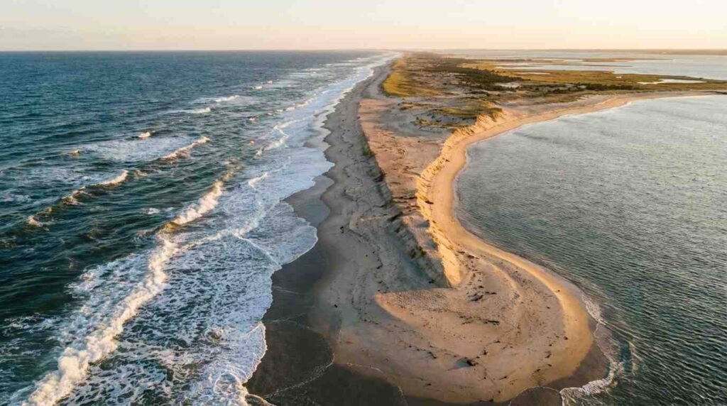
Democrat Point and the Arithmetic of Loss
Democrat Point is the westernmost tip of Jones Beach Island, a spit that extends into the throat of Jones Inlet. It is, in one sense, a success story of sediment accumulation — a natural response to the inlet dynamics that has built considerable land area since Moses’s era. In another sense, it is a symptom. The sand building Democrat Point has been intercepted from the longshore drift system before it can reach the beaches immediately to the east — the western sections of Jones Beach Island that are starving for sediment in direct proportion to Democrat Point’s growth.
This is the counterintuitive arithmetic of inlet sediment budgets. The spit grows where the inlet stops the drift. The beach starves downcoast of the structure. Both phenomena are products of the same intervention.
The USGS Woods Hole Coastal and Marine Science Center has published extensively on barrier island sediment dynamics in the New York Bight, including work on how inlet modifications alter the distribution of sand within barrier island cells. Their research confirms what on-the-ground erosion rates at Jones Beach’s western sections have shown for decades: the Jones Inlet structures have disrupted the natural sediment bypass mechanism that kept these beaches in equilibrium before Moses’s infrastructure program.
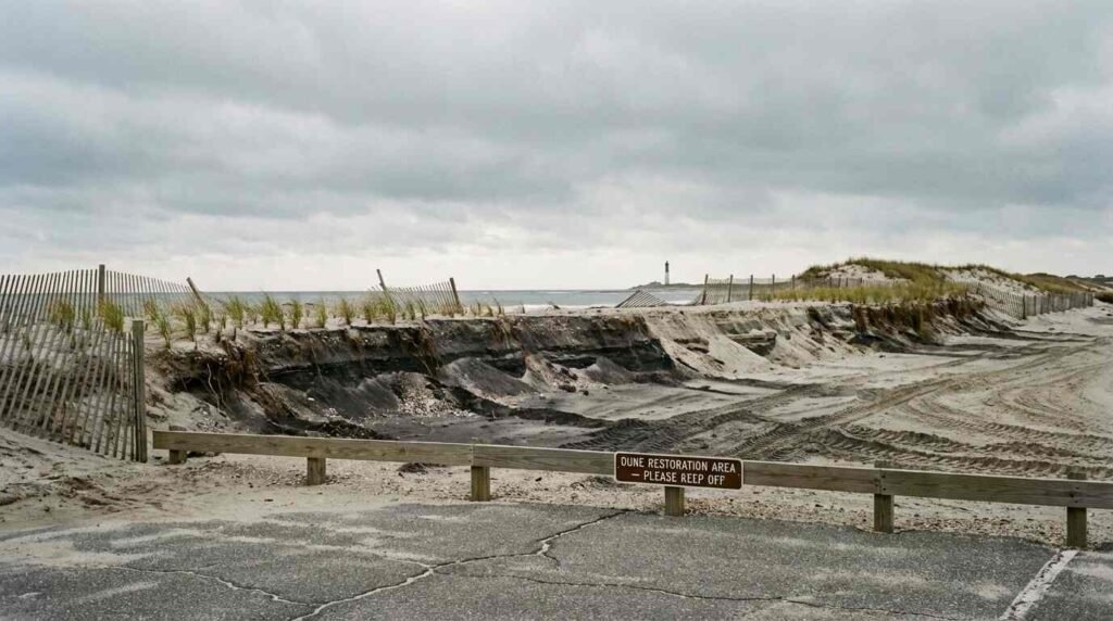
NOAA coastal erosion monitoring data for Jones Beach Island records ongoing shoreline retreat at the island’s western sectors. The numbers vary year to year — beach erosion is not a smooth linear process but an episodic one, with individual storms removing what years of natural accumulation built — but the long-term trend is a retreating shoreline.
Beach Nourishment: The Circulating Debt
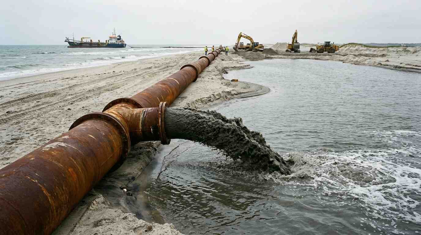
The Army Corps of Engineers’ response to barrier beach erosion in the New York Bight has been, for decades, beach nourishment: the periodic dredging and pumping of sand from offshore borrow areas onto eroding beaches to replace the sediment the longshore drift is no longer delivering.
Beach nourishment works, in the short term, at the site of application. It is also expensive — costs for major nourishment projects along the Jones Beach Island system have run into tens of millions of dollars per cycle — and temporary. Nourished sand placed on an eroding beach enters the same longshore transport system that removed the original material. Without changes to the inlet structures that interrupted the natural sediment supply, nourishment is a maintenance program with no logical endpoint.
This is not a criticism unique to Jones Beach. It is the fundamental tension of barrier island management throughout the eastern United States: the infrastructure we built to access and enjoy these beaches interrupted the sediment systems that built and maintain them, creating a permanent maintenance obligation that escalates as sea level rises and storm intensity increases. The Army Corps’s periodic nourishment of Jones Beach Island sections is not solving the problem Moses created. It is servicing the debt.
What the current round of Army Corps studies — including assessments conducted under the Coastal Storm Risk Management framework in the post-Sandy environment — has begun to address more honestly is whether the existing inlet structures can be modified, whether sediment bypassing systems (mechanical or hydraulic structures that capture drifting sand at inlet jetties and transport it to the downcoast beach) are feasible at this location, and what the long-term cost-benefit arithmetic of continued nourishment looks like against projected sea level rise and storm frequency changes.
These are not purely engineering questions. They are also real estate and community questions. The South Shore communities behind the barrier island — the towns, the bayfront properties, the back-bay ecosystems that the barrier protects — are all downstream of decisions about how to manage the inlet structures Moses built.
I covered the barrier island’s tidal dynamics from another direction — the erosion of the dune system and the loss of the original shore road — in The Dune Road That Drowned. The sediment budget problem and the storm vulnerability problem are not separate phenomena. They are the same system under the same set of pressures.
What Moses Understood — and What He Didn’t
Moses was not ignorant of coastal dynamics. He was, by all accounts, a competent infrastructure administrator who understood the physical environment he was working in well enough to build an enduring recreational system on one of the most energetic and unstable landforms in the northeastern United States.
What Moses did not have — what no one had in the 1920s and 1930s — was a systems-level model of barrier island sediment budgets with sufficient resolution to predict how inlet stabilization would propagate through the longshore drift system over a period of decades. The coastal geomorphological theory that would have allowed that prediction was still being developed. Moses built what his era’s engineering knowledge permitted. The ecological and geomorphological consequences of that construction were not visible at his timescale.
They are visible at ours.
When I look at the lifeguard towers Moses built at Jones Beach — those confident, clean-lined Art Deco structures that still stand at the park’s center — I think about the gap between what infrastructure announces and what it quietly sets in motion. See: [The Lifeguard Towers Robert Moses Built to Watch More Than Swimmers] The towers say: we have mastered this shoreline. The western beach says: not exactly.
The sand is still moving. It will always be moving. The question that the Army Corps of Engineers is trying to answer, with varying degrees of honesty, is whether the system we built is compatible with that movement — or whether it requires us to fight it indefinitely, at escalating cost, on an eroding shore.
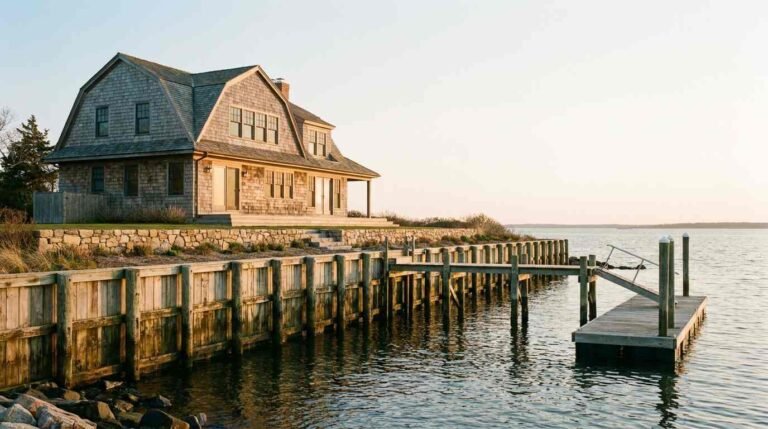
For current listings and market data along Long Island’s South Shore waterfront communities, contact Pawli at Maison Pawli.
Sources
- U.S. Army Corps of Engineers, New York District — Fire Island Inlet to Moriches Inlet Reformulation Study — https://www.nan.usace.army.mil/Missions/Civil-Works/Projects-in-New-York/Long-Island/Fire-Island-Inlet-to-Moriches-Inlet/
- USGS Woods Hole Coastal and Marine Science Center — Barrier Island Sediment Dynamics — https://www.usgs.gov/centers/whcmsc
- NOAA Coastal Erosion Monitoring — Jones Beach Island — https://coast.noaa.gov/digitalcoast/tools/shorelinechangeanalysis.html
- Caro, R.A. (1974). The Power Broker: Robert Moses and the Fall of New York. Knopf.
- Jones Beach State Park, NYSOPRHP — https://parks.ny.gov/parks/jonesbeach/
- Related: The Lifeguard Towers Robert Moses Built to Watch More Than Swimmers
- Related: The Dune Road That Drowned: How Fire Island’s Original Shore Road Disappeared Beneath the Atlantic
- Related: North Shore Bluff Homes and the Erosion Question: What Buyers Need to Know