The Wrack Line as Library: What Jones Beach’s Tide-Deposited Debris Reveals About the Health of the Western Atlantic
Every morning after a storm, Jones Beach’s wrack line is rewritten — a bibliographic record of ocean disturbance, nutrient cycling, and species presence that most beachgoers step over without reading.
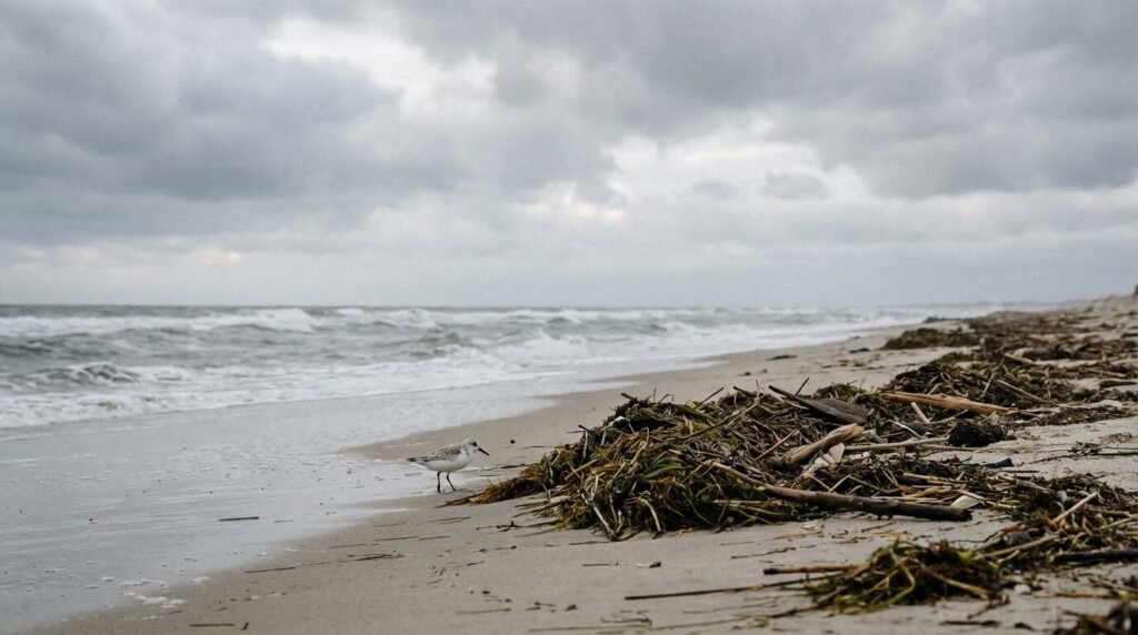
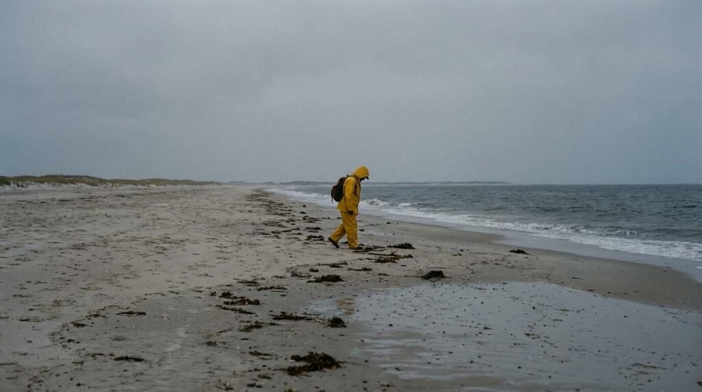
I’ve walked that beach in October, after a nor’easter had worked through the night, and what lies at the tide’s margin stops me every time. Not because it’s beautiful — though some of it is — but because it’s dense with information. The wrack line is the ocean’s correspondence, sorted and delivered by longshore drift and tidal energy onto one of the most heavily visited public beaches in the northeastern United States. Six and a half miles of barrier beachfront, one of the most data-rich marine transect opportunities on the Atlantic coast, and most visitors in flip-flops are navigating around it without a second glance.
That gap between what’s there and what’s perceived is, I think, the central problem of coastal literacy in this region.
What the Wrack Line Actually Is
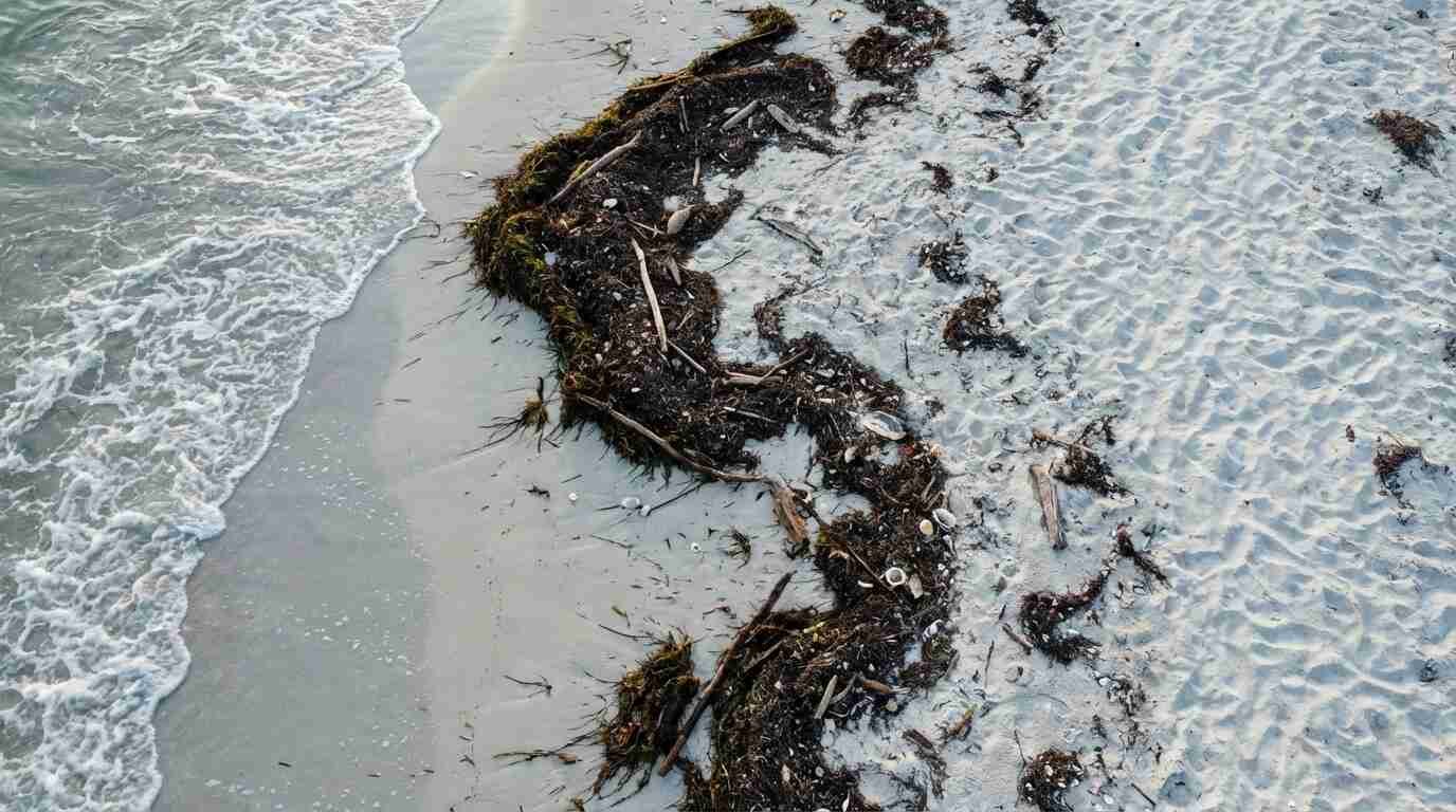
The wrack line — also called the strandline — is the narrow band of material deposited at the high-tide mark as the water retreats. It is not random. It is sorted by the physics of wave energy, drift current, and buoyancy. Dense objects sink. Light objects float. Objects with surface area catch wind and ride farther up the berm.
What accumulates there encodes a biography of the ocean from which it came.
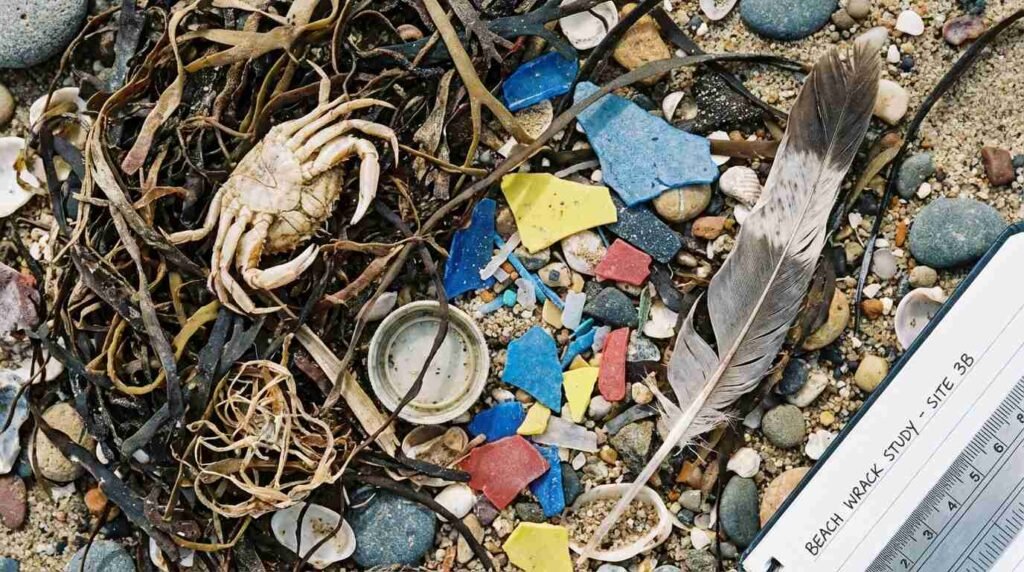
At Jones Beach, a typical post-storm wrack line might include: mats of Sargassum seaweed carried north by the Gulf Stream; the papery, amber-colored egg cases of skates (Raja spp.), known locally as “mermaid’s purses”; hollow molts shed by horseshoe crabs (Limulus polyphemus) during their spawning migrations; the calcified internal shells of common cuttlefish (Sepia officinalis), which have no business being on a New York beach and yet wash up here occasionally, carried from across the Atlantic by the same current system that delivers European sea beans to Caribbean shores; and, woven through all of it, the synthetic residue of the modern ocean — microplastic fragments, fishing monofilament, expanded polystyrene, single-use packaging degraded to the point of near-unrecognizability.
Each of these materials is a signal. The ratio of organic to synthetic, the species composition of the biological fraction, the type and origin of the plastic fragments — all of it is readable, if you know what to look for.
What the Sargassum Tells Us
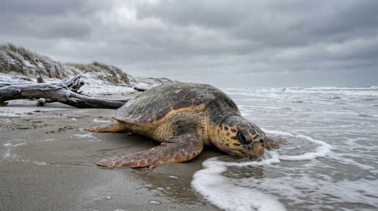
Sargassum natans and Sargassum fluitans are the two floating species that form the vast pelagic meadow of the Sargasso Sea, the only sea on earth bounded by ocean currents rather than landmasses. For centuries, this mat of golden-brown algae has functioned as open-ocean habitat — nursery for juvenile sea turtles, foraging ground for mahi-mahi, refuge for flying fish, and micro-ecosystem for dozens of species of invertebrates that live nowhere else.
When sargassum washes up at Jones Beach, it has ridden the Gulf Stream northward, eventually detaching from the main current and arriving on the South Shore via storm surge or onshore wind. This is normal. What has changed in the past decade is the scale. Unprecedented sargassum blooms in the tropical Atlantic — now documented by NOAA satellite imagery as the “Great Atlantic Sargassum Belt” — have been linked to increased nutrient loading from the Amazon and Congo river systems, likely accelerated by agricultural runoff and deforestation-driven soil loss. The wrack line at Jones Beach, in other words, is receiving mail from the mouth of the Amazon.
This is not metaphor. It is the literal mechanism of global ocean connectivity expressed in the tide-deposited debris of a Suffolk County state park.
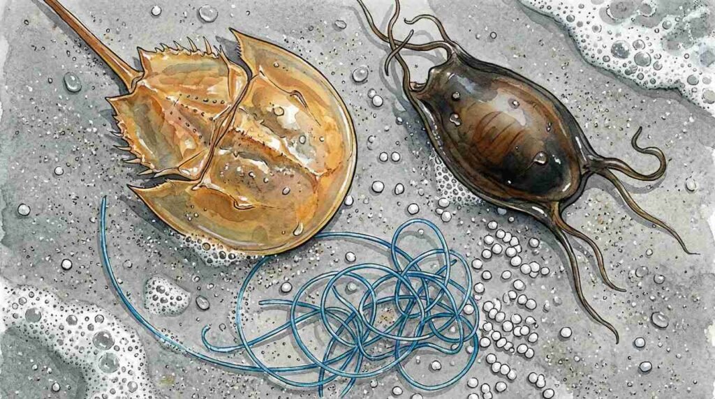
The Horseshoe Crab Molt as Indicator Species
Few organisms are more diagnostically useful in a beach survey than Limulus polyphemus, the Atlantic horseshoe crab. These are not crabs at all — they are chelicerates, more closely related to spiders and scorpions, and their lineage is approximately 450 million years old. They are one of the few animals on earth that have not materially changed since the Ordovician.
The molts — the shed exoskeletons left behind as juveniles grow — accumulate along the Jones Beach strandline through late spring and summer. Their presence in quantity indicates a healthy spawning population in the adjacent South Shore bays and inlets. Their absence, or the presence of whole adult animals rather than molts (a sign of mortality, not growth), is a different signal entirely.
Horseshoe crab populations on Long Island’s South Shore are under pressure from multiple directions: habitat loss in the shallow bay systems where they spawn, harvest pressure from the biomedical industry (their copper-based blood contains Limulus amebocyte lysate, the standard reagent for endotoxin testing in pharmaceutical manufacturing), and disruption of migratory shorebird systems that depend on their eggs as fuel for long-distance spring migration. [VERIFY: Current horseshoe crab population status for New York Bight — check ASMFC horseshoe crab stock assessment before publishing.]
What the wrack line shows you, if you’re counting molts versus intact mortalities, is which of these pressures is currently winning.
Plastic as Permanent Record
The synthetic fraction of the Jones Beach wrack line is where the ecological reading becomes most unambiguous — and most disheartening.
SUNY Stony Brook’s School of Marine and Atmospheric Sciences has been among the institutional leaders in understanding plastic pollution dynamics in the waters of the New York Bight. Dr. Christopher Gobler’s coastal ecology lab has documented nutrient loading and phytoplankton dynamics in South Shore waters — work that connects to wrack composition because eutrophication and plastic accumulation share common sources in agricultural runoff, urban stormwater, and inadequate wastewater treatment. The NOAA Marine Debris Program maintains monitoring stations along the New York Bight coast, including the Jones Beach Island shoreline, tracking debris type, quantity, and origin.
The plastics in any given wrack line tend to fall into three categories: macroplastics (items large enough to identify by use), mesoplastics (fragments between 5mm and 25mm), and microplastics (fragments below 5mm, including the notorious “nurdles,” the pre-production resin pellets that are the raw feedstock of the plastics industry and which accumulate in beach sediments worldwide).
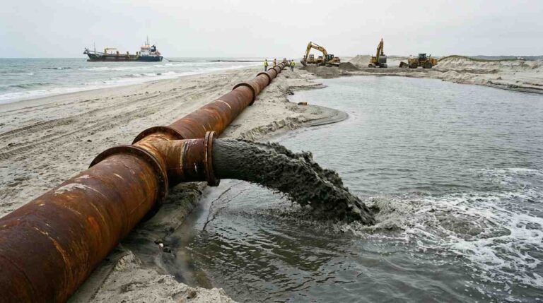
The ratio of these categories tells a story about proximity to source. A beach dominated by macroplastics is close to a discharge point — a stormwater outfall, a marina, a heavily trafficked recreational waterway. A beach where microplastics dominate the synthetic fraction indicates that the material traveled a long distance and experienced significant wave action before arrival, breaking down en route. At Jones Beach, surveys have found both — a layered record of local discharge (think: parking lot stormwater from a state park that receives more than six million visitors annually) and oceanic drift from sources far offshore and farther up the eastern seaboard.
The microplastics have an additional consequence that the macrofragments do not: they move into the food web. Surf clams, blue mussels, and ribbed mussels — all present in the bays behind Jones Beach Island — are filter feeders that cannot distinguish between phytoplankton and a 2mm polyethylene fragment. Neither can the sanderlings and dunlins working the wrack line at the water’s edge.
The Biological Fraction as Food Web Audit
Beyond sargassum and horseshoe crabs, a complete wrack inventory at Jones Beach includes a roster of organisms that function as ecological indicators in their own right.
Sea beans — the seeds of tropical and subtropical plants, carried north by the Gulf Stream — are the longest-traveled objects in any wrack line. A hamburgbean (Mucuna sloanei) or a Mary’s bean (Merremia discoidesperma) on a Long Island beach has potentially drifted for years from a Central American river mouth, through the Caribbean, into the Gulf Stream’s northward sweep, and finally been deposited here by an onshore wind event. Their presence confirms Gulf Stream connectivity. Their absence during a period when they should be arriving can indicate disruption of normal current patterns.
Dead-by-morning invertebrates — the amphipods, isopods, and sand hoppers that colonize fresh wrack within hours of deposition — are themselves a food source for a chain of predators from ghost crabs to laughing gulls to migratory shorebirds. A rich organic wrack line supports this invertebrate community. A synthetic-dominated one does not. This is why wrack removal programs at heavily managed beaches — a common intervention when tourism aesthetics compete with ecological function — are more damaging than they appear. When municipalities rake their beaches clean, they are removing the base of the food web, not just the unsightly debris.
Jones Beach State Park, to its credit, does not rake the entirety of its natural beachfront, preserving wrack accumulation in less-developed sections. This is worth noting as a management decision, because it is not universal.
Reading the Ratio
The central diagnostic question in wrack ecology — the one that marine debris researchers come back to repeatedly — is this: what is the ratio of organic to synthetic material?
In a functionally healthy coastal system, organic material dominates the wrack line. Sargassum, kelp, dead fish, invertebrate molts, seagrass wrack from the bay side — these are the primary constituents of a beach strandline that reflects a productive, biologically active nearshore zone. As the ratio shifts toward synthetic, it encodes two simultaneous failures: increased plastic input into the ocean system, and decreased biological productivity in the waters supplying the wrack.
Research on wrack ecology by Colombini and Chelazzi (2003, Biological Reviews) established the foundational framework for understanding wrack as habitat rather than debris — documenting how strandline invertebrate communities structure the transfer of marine productivity to terrestrial and avian food webs. Subsequent work has built on this to examine how plastic contamination disrupts the wrack community’s ecological function, not just its aesthetic character.
At Jones Beach, that ratio is measurably worse than it was fifty years ago. The wrack line I walk in October is not the wrack line that existed when the park was new.
I find that worth sitting with for a moment, before reaching for solutions.
What Jones Beach Can Teach Us
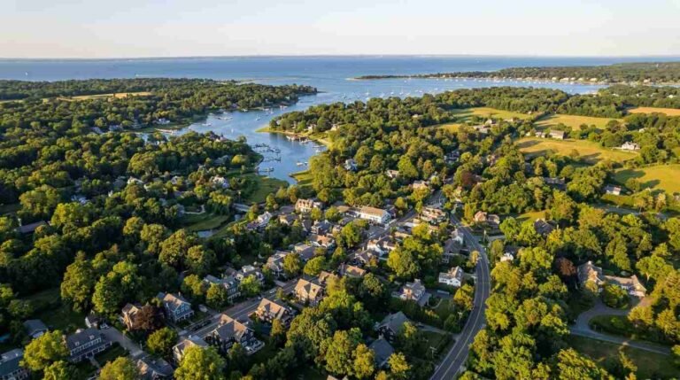
There is something particular about Jones Beach as a site for this kind of reading. It is not a remote wilderness beach. It is one of the most heavily engineered recreational landscapes in the northeastern United States — built by Robert Moses, managed by the state, visited by millions, abutted by the densely urbanized South Shore of Long Island. Its wrack line is not pristine. It cannot be. And that is precisely what makes it interesting as an ecological text.
The Jones Beach wrack line encodes both the global ocean system — Gulf Stream dynamics, Atlantic plastic accumulation, tropical seed dispersal — and the immediate human geography of its surroundings: the Nassau County drainage districts, the parking lot runoff, the recreational boat traffic in the Great South Bay behind it. It is local and planetary simultaneously.
This is what the Eelgrass crisis I wrote about in Peconic Bay — which I covered for the bayfront buyer audience — and the horseshoe crab population dynamics share with the wrack line: they are all readings of the same underlying system, the South Shore’s layered ecology of bays, inlets, and open ocean, under the particular pressures of this particular place and this particular historical moment.
You can learn more from an hour’s walk along the strandline after a storm than from most briefings I’ve sat through about coastal ecosystem health. The ocean leaves its notes. The question is whether we’re in the habit of reading them.
For current listings and market data along Long Island’s South Shore and waterfront communities, contact Pawli at Maison Pawli.
Sources
- SUNY Stony Brook School of Marine and Atmospheric Sciences — https://www.somas.stonybrook.edu/
- Gobler Lab, Stony Brook University — https://you.stonybrook.edu/goblerlab/
- NOAA Marine Debris Program — https://marinedebris.noaa.gov/
- NOAA Great Atlantic Sargassum Belt monitoring — https://oceanservice.noaa.gov/hazards/sargassum/
- Colombini, I. & Chelazzi, L. (2003). Influence of marine allochthonous input on sandy beach communities. Biological Reviews, 78(2), 311–397. https://doi.org/10.1017/S1464793102006012
- Jones Beach State Park, New York State Office of Parks, Recreation and Historic Preservation — https://parks.ny.gov/parks/jonesbeach/
- Atlantic States Marine Fisheries Commission — Horseshoe Crab Stock Assessment — https://www.asmfc.org/species/horseshoe-crab
- Related: The Lifeguard Towers Robert Moses Built to Watch More Than Swimmers
- Related: The Eelgrass Crisis in Peconic Bay