The Unbuilt Babylon: Robert Moses’s Master Plan for a South Shore Parkway Village That Would Have Erased Three Neighborhoods
The blueprints that never became buildings tell a different story than the ones that did.
I’ve spent a lot of time thinking about what Long Island was supposed to become — the landscape imagined by the men who held the power to shape it, in the decades when a few figures with state authority and federal money could reorganize the physical world without much public accountability. Robert Moses is the obvious center of that story, and Robert Caro told most of it. But Caro’s The Power Broker is, by its nature, a book about what Moses built. The projects that failed, the blueprints that died in committee, the proposals that were defeated by people who refused to move — those are harder to reconstruct, and easier to forget.
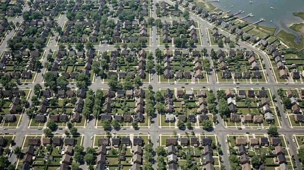
In 1944, Moses submitted to the Long Island State Park Commission a comprehensive redevelopment blueprint for a corridor stretching from Amityville to Bay Shore — a plan that would have demolished existing residential blocks and replaced them with a model parkway community of his own architectural specification. The plan failed. It has been almost entirely forgotten. And its failure, it turns out, was not an accident.
The Plan, as It Existed
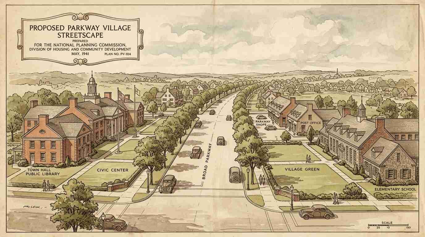
The 1944 proposal, referenced in Moses’s own correspondence and in Long Island State Park Commission records, called for a coordinated architectural intervention along an extended Southern State Parkway spur running through the western townships of Suffolk County. What Moses envisioned was not merely infrastructure. It was a parkway village — a concept with a specific aesthetic genealogy rooted in the Garden City movement and adapted through his own aesthetic preferences into something more rigidly controlled.
The proposed streetscape would have featured Colonial Revival civic buildings flanking the extended parkway corridor, with housing blocks designed by Moses’s preferred architects replacing what his internal memos described, with characteristic bluntness, as “substandard residential fabric.” The phrase did a great deal of work. It rationalized demolition. It transformed the question of whose homes these were into a question of architectural quality — a question Moses felt fully qualified to answer.
The architects he favored for the project were the same men he had employed on Jones Beach’s bathhouse complexes and the parkway bridge abutments that are, to this day, some of the most quietly beautiful pieces of public infrastructure on Long Island — low, muscular, slightly Romanesque in their massing, built to feel like they had been there forever. The parkway village would have extended that aesthetic sensibility into the residential fabric. Seen on paper, it has a coherent architectural vision. Seen in context — against what it would have required — it is something else entirely.
The Blocks Targeted
The specific residential blocks targeted for demolition in the 1944 plan included several in western Babylon township that were, and are, a more complicated part of Long Island’s history than Moses’s memos acknowledged.
Among the neighborhoods in the direct path of the proposed corridor was a section of Amityville whose Black homeowner community had established itself over several decades of careful, legally contested accumulation. Long Island’s history of residential segregation is well-documented — the restrictive deed covenants that shaped so many North Shore communities operated with equal force on the South Shore, often more aggressively — but within those constraints, Black families in western Babylon had built something real. Streets of owner-occupied houses. A community infrastructure of churches, social organizations, and small businesses. The kind of rooted neighborhood life that is precisely what Moses’s memos dismissed as “substandard.”
The plan would have displaced them without negotiation. The parkway village Moses imagined was not conceived as a racially integrated community. The existing residents of the targeted blocks did not fit that vision. The plan did not account for where they would go.
This was not unusual for Moses’s urban renewal work in New York City, where the displacement calculus was made explicit in the Cross Bronx Expressway and dozens of other projects. What is unusual is that in western Babylon, the plan failed.
Why It Failed
The organized resistance that defeated the 1944 South Shore Parkway Village proposal came primarily from Amityville — and significantly, from the Black homeowner community whose neighborhood was in the direct path of the proposed corridor.
What the Amityville Record documented in the mid-1940s — and what state commission records bear out — was not a dramatic public confrontation but something more durable: a sustained legal and political challenge mounted by homeowners who understood that their most effective tool was the legal standing that came with property ownership. They hired lawyers. They attended commission hearings. They put their names on documents and made the commission account for each property it proposed to acquire. Moses had defeated this kind of opposition before, and he would again. But in this case, the combination of legal costs, political complications during a wartime period when large-scale domestic displacement was difficult to defend publicly, and the organizational cohesion of the targeted community was enough. The plan died in committee.
There is a particular irony in the mechanism of its defeat. The restrictive deed covenants that had made Long Island’s residential landscape so segregated had also, paradoxically, created concentrations of Black homeownership in specific pockets — neighborhoods where enough families had accumulated enough legal standing to mount effective resistance. Moses’s plan encountered a community that owned what he wanted to take.
What Would Have Been Built
The architectural specifications for the parkway village, as they appear in Moses’s correspondence and commission records, are striking in their coherence and their grandiosity.
The Colonial Revival civic buildings — a library, a community center, potentially a school — were designed to anchor the corridor at regular intervals, giving the extended parkway spur the institutional weight of an established village center rather than the anonymous feel of a highway. Between these anchors, the housing blocks would have provided a controlled residential environment with consistent setbacks, approved landscaping, and architectural uniformity of a kind that Moses’s parkways enforced even where they ran through existing neighborhoods.
The housing design reflected the modernist-inflected Colonial Revival hybrid that was the dominant idiom of public and semi-public construction in New York State during Moses’s long tenure — not the full International Style modernism of the 1932 MoMA show, but a rationalized version of traditional American residential architecture that had absorbed the modernist lesson about massing and fenestration while retaining the pitched roof and the punched window.
What they would have produced, had the plan proceeded, was probably not unbeautiful. Moses had enough aesthetic judgment — and enough authority over his architects — to produce built environments with genuine visual coherence. Jones Beach remains, eighty years later, an argument for what controlled design authority can accomplish. The parkway village would have had something of the same quality: the look of a place that was thought about. The problem, of course, is not the architecture. The problem is what was there before.
The Intact Housing That Survived
The specific blocks that Moses targeted for demolition in western Babylon township contain, today, a collection of pre-war residential architecture that is now considered historically significant by the Town of Islip’s historic preservation framework and by survey work done through the New York State Historic Preservation Office.
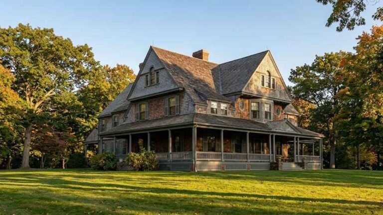
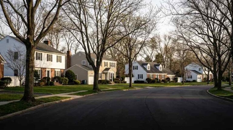
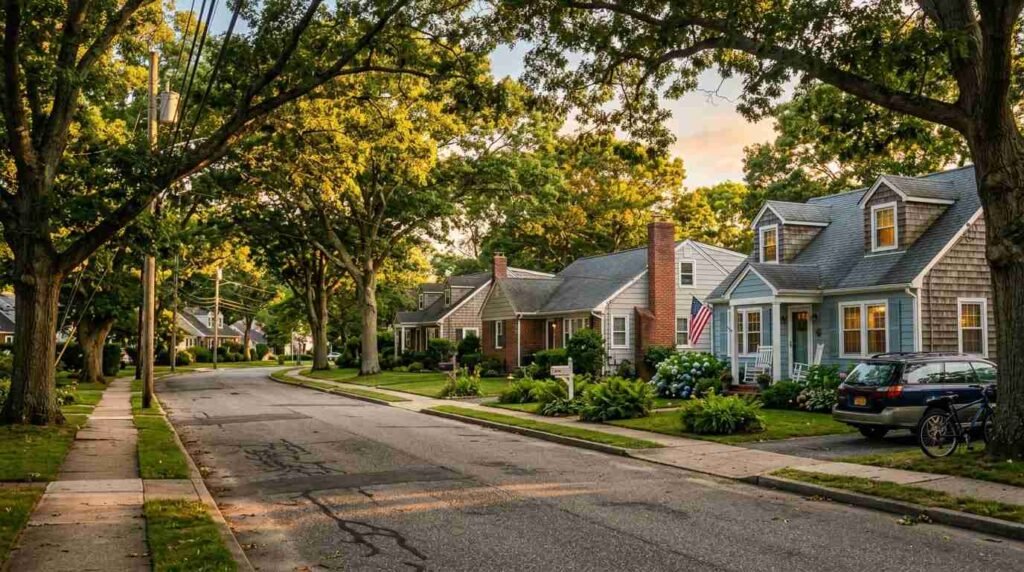
The houses are not grand. They are the ordinary residential architecture of the 1920s and 1930s — Colonials, Capes, bungalows, the occasional Craftsman-influenced foursquare — built for families of modest means who were making a life on the South Shore when the South Shore was still, in many places, farmland at the edges. Their significance is not stylistic. It is historical. They are the physical evidence of a community that existed, that resisted, and that survived.
From a real estate perspective — and I am, after all, a broker, even when I am writing history — the survival of that pre-war housing stock has had a straightforward consequence: those blocks are now among the most architecturally coherent residential streets in their respective neighborhoods. The involuntary uniformity that comes from a single period of construction and a shared economic context produces, decades later, a streetscape with a character that post-war suburban development rarely achieves. The houses are the right size for their lots. The trees have had eighty years to grow. The blocks look, in the best sense, settled.
Moses would have erased all of that for a parkway village that was never built. The community that stopped him was protecting their homes. The architectural legacy they preserved was a side effect.
What the Unbuilt Projects Reveal
There is a long scholarly literature on Moses’s built work — the parkways, the beaches, the bridges, the housing projects — and a smaller but growing literature on his planning ideology. The unbuilt projects have received less attention, partly because they are harder to find and partly because the drama of the built record is so overwhelming.
But the 1944 South Shore Parkway Village proposal is worth recovering for what it shows about Moses at a specific moment: not yet at the peak of his post-war authority, still navigating wartime political constraints, and encountering a form of organized community resistance that his later projects — with more federal money and more political cover — would have flattened without difficulty.
It also shows the full scope of his aesthetic and social ambitions. Moses was not merely a builder of infrastructure. He was a builder of environments — controlled, coordinated, architecturally unified environments that reflected a specific vision of how people should live and who, implicitly, those people were.
And it shows — perhaps most importantly — that the landscape of Long Island was not inevitable. The communities that exist, the streetscapes that survived, the blocks with eighty-year-old trees and pre-war housing: these are not simply the result of the market and the clock. Some of them exist because people with far less power than Moses stood in front of commission members and refused to move.
That is worth knowing. It is worth knowing on the North Shore too, where the same forces — the same tools of planned demolition and coordinated redevelopment — operated with equal vigor and less resistance in some places, and met organized community refusal in others. The landscape we sell and buy and live in is not neutral. It is the result of a long series of decisions, some of which were made by people in offices, and some of which were made by people who would not leave their homes.
I think about that when I’m driving certain streets. The trees. The scale. The way a block has held together across eight decades. Someone fought for that. Sometimes we don’t know who.
Real estate markets change. For current listings and market data, contact Pawli at Maison Pawli.
You Might Also Like
- The Servant Stair and the Service Wing: What the Hidden Architecture of Gold Coast Estates Reveals About Today’s Luxury Floor Plans
- The Lifeguard Towers Robert Moses Built to Watch More Than Swimmers
- The Covenant in the Deed: How Restrictive Covenants Shaped Long Island Neighborhoods — and What Buyers Find There Today
Sources
- Robert Moses Papers, Manuscripts and Archives Division, The New York Public Library
- Long Island State Park Commission Records, New York State Archive, Albany
- Amityville Record, historical archive, 1944–1946
- Robert A. Caro, The Power Broker: Robert Moses and the Fall of New York (Knopf, 1974): penguinrandomhouse.com
- New York State Historic Preservation Office: nysparks.com/shpo
- Town of Babylon, Building and Zoning Department: townofbabylon.com