Port Jefferson’s Shipyard Soil: What Brownfield Remediation Cores from the Former Bayles Shipyard Site Accidentally Preserved About 19th-Century Industrial Life on the Harbor
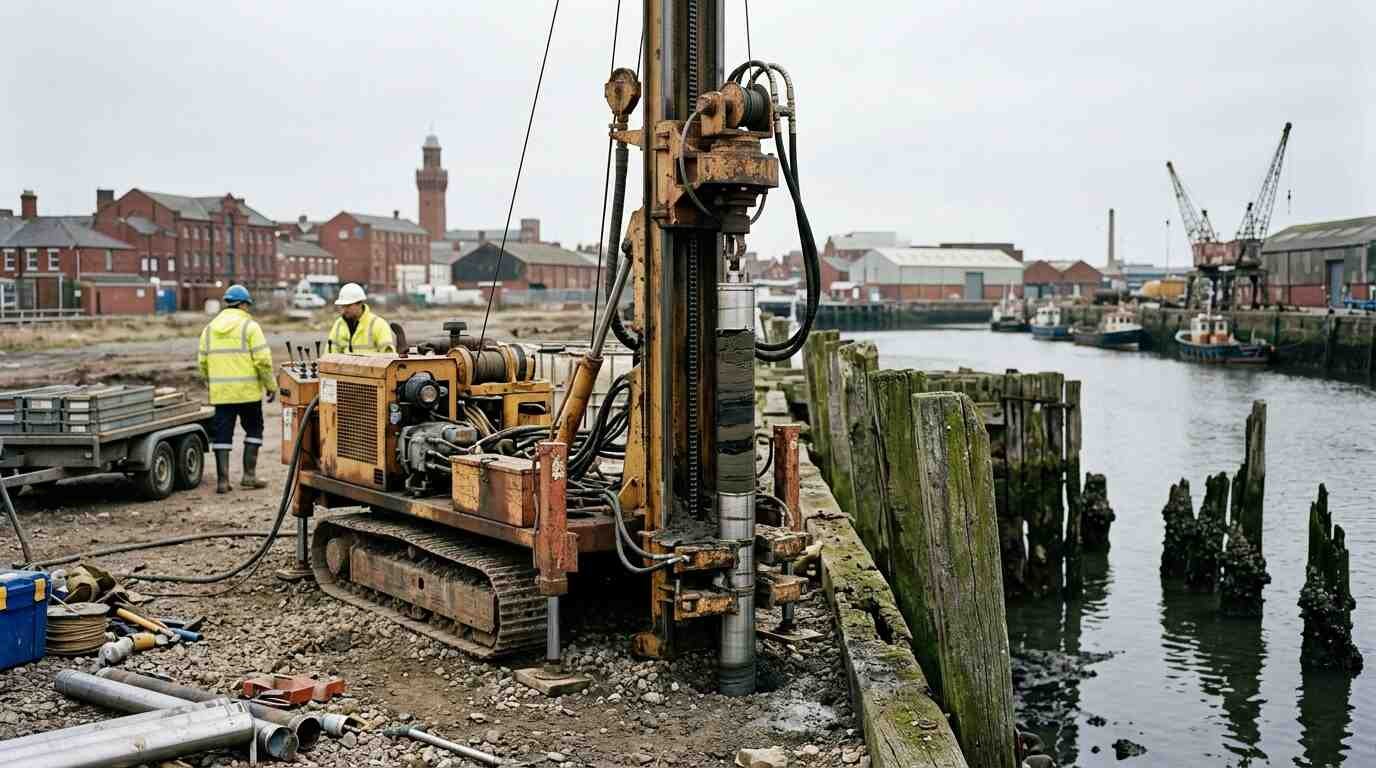
The drill rig arrives for one reason. It is looking for contamination — the heavy metal plumes, the petroleum hydrocarbon signatures, the chlorinated solvents that accumulate in the soil beneath industrial sites and that NYSDEC’s Brownfield Cleanup Program tracks, measures, and requires to be addressed before a site can be redeveloped. The cores it pulls from the ground are environmental evidence, samples to be analyzed for chemistry, reported in tables, entered into databases that measure the distance between what is there and what the regulatory standard permits.
Nobody sends a drill rig to Port Jefferson’s former Bayles Shipyard site looking for history.
But the cores come up with both.
The Bayles Shipyard operated along Port Jefferson Harbor through much of the 19th century — one of the most historically documented shipbuilding operations on Long Island’s north shore, according to the Three Village Historical Society archives and the published historical work of scholars like Barbara Russell on Port Jefferson’s 19th-century maritime economy. The environmental site investigation records on file with the NYSDEC Brownfield Cleanup Program and the Suffolk County Department of Health Services constitute, read correctly, an inadvertent stratigraphic archive of that operation. Not the chemistry — though the chemistry is there too — but the physical record: the layering of materials that 150 years of shipbuilding deposited in this harbor-edge soil, core section by core section, in a sequence that time has not scrambled.
The Bayles Shipyard in the Historical Record
The Bayles family’s shipbuilding operation was not a minor enterprise. Port Jefferson, in its 19th-century peak, was one of the most productive shipbuilding centers on Long Island Sound, and the Bayles yard was central to that production. The Three Village Historical Society holds shipbuilding-era records — contracts, launch records, employment accounts, correspondence — that document the yard’s output and its organization in enough detail to make it one of the better-documented 19th-century industrial sites on the north shore.
What those records document is the physical organization of the yard: the ways, the timber storage areas, the blacksmith shop and ironworks, the caulking stations, the paint and pitch storage, the joiners’ sheds. Barbara Russell’s published historical work on Port Jefferson’s maritime economy provides the interpretive framework for understanding how these elements fit together as a functioning industrial complex. The Three Village Historical Society’s geographic documentation allows that framework to be mapped onto the specific topography of the harbor shoreline.
When you read that map against the environmental core data, something happens. The documented locations of specific yard functions — the ironworks here, the pitch storage there, the caulking station along this section of the harbor edge — correspond to specific chemical signatures in the remediation cores. The ironworks location shows elevated iron and heavy metal concentrations. The pitch and tar storage area shows hydrocarbon signatures consistent with coal-tar distillates. The caulking station area shows the particular mix of organic compounds associated with marine caulking compounds of the period.
The environmental chemistry is, in this reading, a spatial map of the industrial yard. The contamination is a document.
What the Physical Core Sections Contain
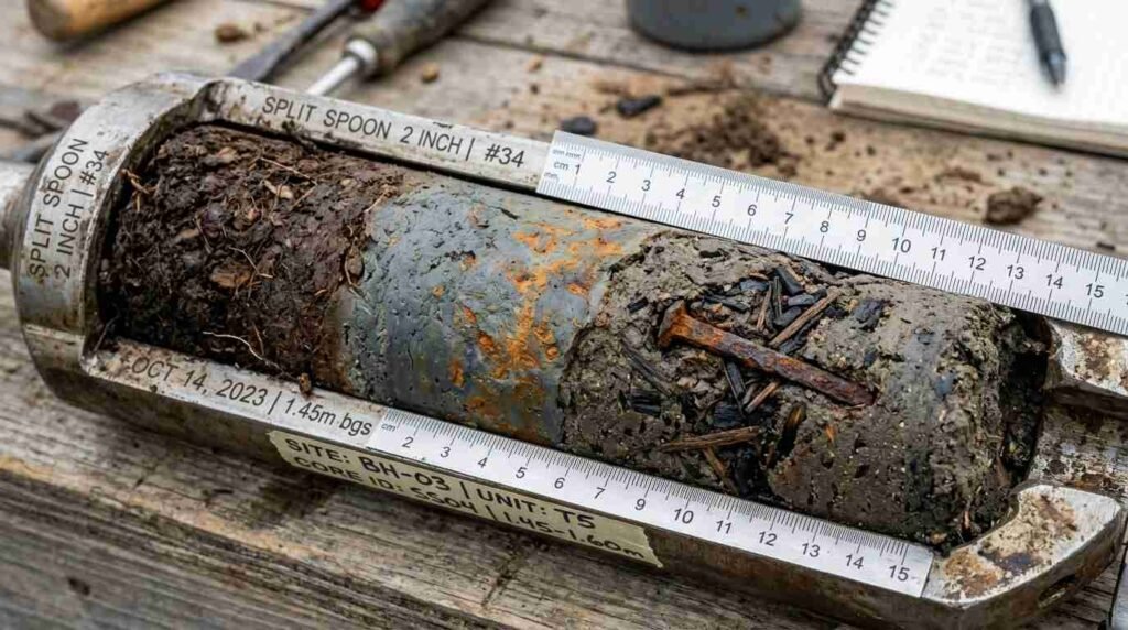
Beyond the chemistry, the physical core sections — the actual sediment cylinders pulled from the ground — contain materials that are not chemical signatures but physical artifacts: fragments of the materials that the shipbuilding operation produced and discarded over 150 years of operation.
Caulking material — the oakum (tarred hemp fiber) used to seal the seams of wooden hulls — is recoverable from the core sections where the caulking station was located. The material has changed character over 150 years in the ground, but its fibrous structure and tar impregnation are distinctive enough to identify. Iron fastener fragments — the square-cut nails, spikes, and bolts of 19th-century wooden shipbuilding — appear in the core sections corresponding to the ironworks and fabrication areas. Wood species fragments, identifiable to species through wood anatomical analysis, document the timber preferences of the yard over time: live oak for frames, white oak for planking, pitch pine for deck work, spruce for spars.
These materials constitute what archaeologists call a material biography of the site: a physical record of what was done here, with what materials, over what period of time. The wood species sequence, in particular, is informative. Early in the yard’s operation, the core sections contain live oak — the preferred frame timber of 19th-century wooden shipbuilding, increasingly scarce as the century advanced. Later sections show a shift toward white oak and lesser substitutes, tracking the timber supply constraints that affected the entire industry in the second half of the century. The cores record the resource depletion that contributed to the industry’s decline.
Contamination as Timestamp
The hydrocarbon chemistry in the Bayles site cores is an inadvertent timeline of the harbor’s industrial history. The pre-petroleum era — the period of the wooden shipbuilding yard’s active operation — left a specific chemical signature: coal-tar distillates from the pitch and tar operations, animal fat residues from the caulking compounds, heavy metals from the blacksmithing and ironwork. These are the contamination profile of the early industrial harbor.
The transition to petroleum-based compounds in the late 19th and early 20th century — as the wooden shipbuilding industry gave way to mechanical repair and boat storage operations on the harbor — is visible in the chemistry as a shift in the hydrocarbon signature. The older compounds persist below; the newer ones accumulate above. The contamination record is a stratigraphy, and the stratigraphy is a timeline.
The NYSDEC Brownfield Cleanup Program records and the Suffolk County Department of Health Services environmental site files contain the data that makes this reading possible. Those records were not generated for historical purposes, and the data they contain has not been systematically read as historical evidence. But the data is there, and the historical record against which it can be interpreted — the Three Village Historical Society archives, the maritime economy scholarship — is also there.
Reading the two together produces a picture of the Bayles Shipyard that neither source could produce alone.
Brownfield Redevelopment and the Historical Record
The NYSDEC Brownfield Cleanup Program is, in its purpose, about the future of industrial sites — about removing contamination, restoring soil quality, and making redevelopment possible. The Bayles Shipyard site’s remediation is part of the ongoing effort to return Port Jefferson’s harbor edge to productive use.
What the remediation process has incidentally produced — the core data, the contamination maps, the physical sample archive — is a record of the site’s industrial past that would not exist without the environmental investigation. In this sense, the brownfield process is an inadvertent heritage program: by investigating the site thoroughly enough to understand its contamination, it has also documented its history in physical and chemical terms that no other investigation methodology could have produced.
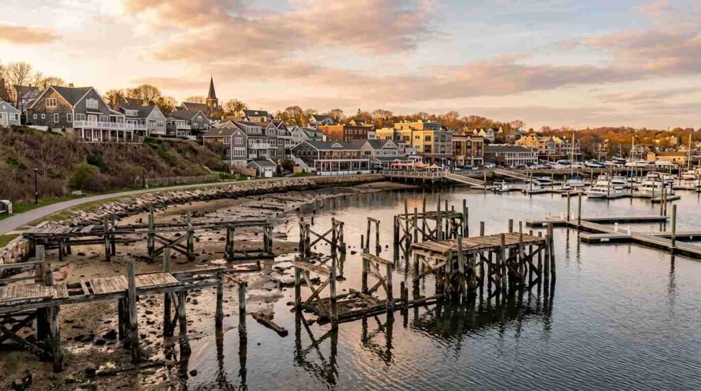
Port Jefferson’s ongoing reinvention as a real estate market is partly a function of this harbor-edge redevelopment — the conversion of former industrial waterfront to residential, commercial, and recreational use. That conversion is, in the most literal sense, building on top of the shipbuilding history that the brownfield cores have been documenting. The new uses are real. The history beneath them is also real, preserved in core sections in a laboratory archive and in the chemical signature of the soil.
The village that the Bayles family built from wood and water is in the ground below the village that replaced it. The drill cores know both.
Sources
- NYSDEC Brownfield Cleanup Program records for Port Jefferson Harbor: https://www.dec.ny.gov/chemical/8450.html
- Suffolk County Department of Health Services environmental site files: https://www.suffolkcountyny.gov/Departments/Health-Services
- Three Village Historical Society shipbuilding collections: https://www.tvhs.org
- Barbara Russell, historian — Port Jefferson 19th-century maritime economy: published through Three Village Historical Society; verify current availability through TVHS.