The Easement You Didn’t Know You Bought: Why Utility and Access Rights Recorded Before 1960 Are the Hidden Variables in Any Home Purchase
Somewhere in the Suffolk County Clerk’s records, recorded in the early decades of the twentieth century, is a document that affects the buildable footprint of a property that probably hasn’t thought about it since the Eisenhower administration. The owner who sold it in 1982 didn’t mention it. The owner who bought it in 2004 didn’t ask. It showed up in the title commitment that year — somewhere in Schedule B-2, a few lines in dense legal boilerplate — and whoever read the commitment either didn’t notice or didn’t understand what it meant.
Now it’s your turn. And if you’re not looking for it before you make your offer, you may be the next person who discovers it after closing.
What an Easement Actually Is
An easement is a legal right, held by someone other than the landowner, to use a portion of a property for a specific purpose. The property it crosses is called the “servient estate.” The party holding the right — whether a neighbor, a utility company, or a municipal entity — is the easement holder. Easements are created by written agreement (express easements), by long-term open use without permission (prescriptive easements), or by strict legal necessity (easements by necessity, typically used to give a landlocked parcel access to a public road).
What makes easements consequential for buyers is a fundamental principle of property law: easements run with the land. This is not a technicality — it is the entire operating logic of the easement system. An easement created in 1947 between a prior owner and a utility company is not a deal between those parties. It is a permanent encumbrance on that piece of land, binding on every subsequent owner, regardless of whether they knew it existed, regardless of whether it was disclosed at the time of their purchase. The New York Real Property Law and the Restatement (Third) of Property: Servitudes both affirm this principle without exception.
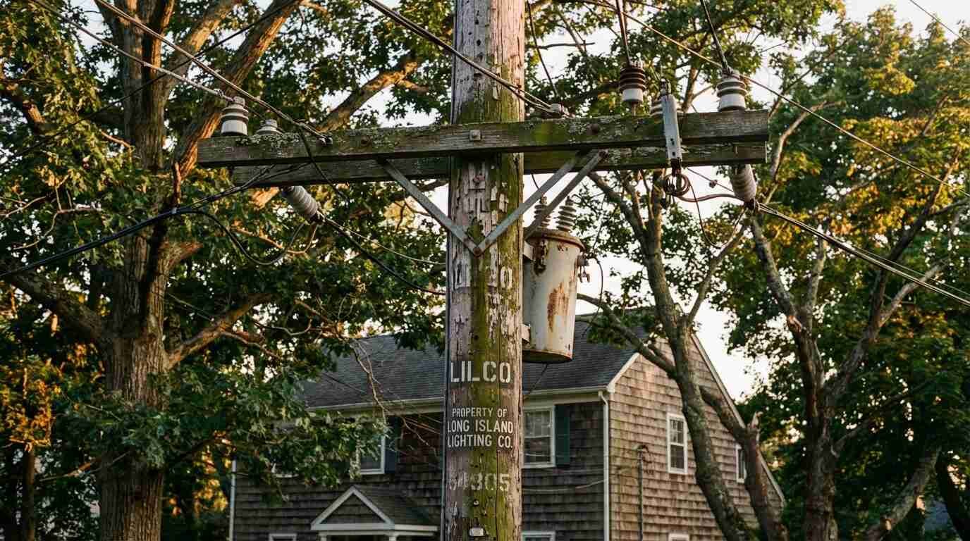
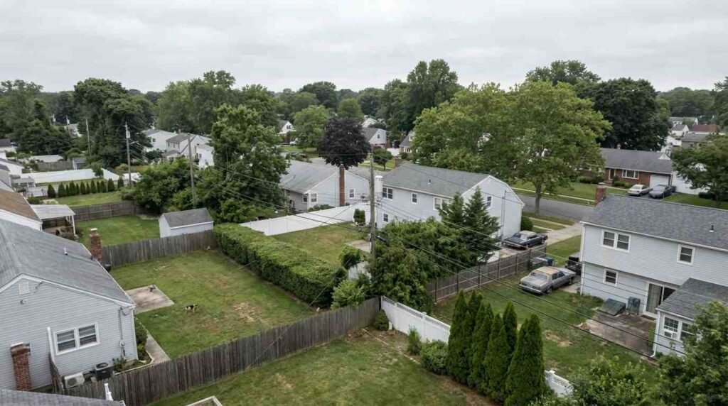
LILCO and the Easement Grid It Built Across Long Island
Beginning in 1910, when the Long Island Lighting Company was formed from the merger of four small Suffolk County utilities, LILCO began the methodical work of building a power grid across a rapidly developing island. By the 1920s, with Long Island in the middle of a significant real estate boom, LILCO was acquiring easements across private property at scale — overhead lines, underground conduits, transformer access corridors. By the 1940s, following the wartime expansion of infrastructure to serve Camp Upton and other military facilities, and the immediate postwar explosion of new construction in Levittown and its successors, the easement grid had reached into nearly every corner of Nassau and Suffolk counties.
These easements were recorded with the county clerk, as the law required. They appear in the deed chains of thousands of Long Island properties. But because they were created by prior owners, often before a house was even built on the lot, and because they’ve been listed in every title commitment since without triggering any obvious problem, most buyers have learned to read past them. A line in Schedule B-2 reading “subject to easement for utility purposes, recorded Liber 1847, page 312, dated October 14, 1938” is easy to skip.
What it means in practical terms is harder to skip. That easement corridor — wherever it runs on the lot — typically carries restrictions on what can be built within it. The current PSEG Long Island easement terms for its facilities on private property specify that the easement holder retains access rights, that the property owner cannot construct permanent structures within the corridor, and that vegetation may be controlled or removed within it. The width of historic LILCO easements varied, but ten-to-fifteen-foot corridors were common. A ten-foot easement cutting diagonally across the rear of a relatively small lot can eliminate the most logical location for a garage, a pool, or an accessory structure — even when the town would otherwise permit one there.
Right-of-Way Grants and Shared Access Strips
Utility easements are the most common, but they’re not the only pre-1960 easements that show up in title chains. Right-of-way grants between neighboring landowners are nearly as common on the North Shore, and their origins are often invisible without actually reading the underlying document.
Consider what the original subdivisions of North Shore land looked like before modern subdivision regulations imposed consistent lot layouts and road frontage requirements. Many parcels were created when a larger landowner sold off pieces of an estate or farm, and the configuration of those sales didn’t always give every new parcel direct road access. A landlocked interior parcel needed a right-of-way across an adjacent lot to reach the public road. The landowner granted it by deed, it was recorded, and it attached to both parcels: as a benefit to the landlocked lot and a burden on the lot it crosses.
Fifty years later, the landlocked lot has road access from a different direction — perhaps the town built a new street, or the original lot was eventually subdivided again. The right-of-way that was granted in 1939 may have become practically unnecessary. But unless it was formally extinguished by a recorded release signed by both parties, it remains in the title chain. If the easement holder can no longer be located — if the benefited parcel has changed hands multiple times and no one has actively maintained the right — there may be a good argument for extinguishment. But that argument requires a real property attorney, and it takes time.
Drainage Easements and the Contours of the Land
In the low-lying areas of Long Island’s South and North shores — near tidal inlets, alongside former agricultural drainage ditches, in neighborhoods built on filled wetland — drainage easements are common and often consequential. A municipality that required a drainage easement as a condition of subdivision approval in 1955 may have placed that easement in a location that no longer corresponds to any visible feature of the landscape. The drainage pipe it was meant to protect may have been relocated or abandoned. The water table it was intended to manage may behave differently after decades of development upstream.
But the easement remains. And if you purchase the property and then propose a building project that would disturb the easement corridor, you will learn about it — either from your contractor’s survey, your permit application, or, in the worst case, from the municipality or neighboring property owner who holds the drainage right.
As I wrote in the post on North Shore bluff homes, coastal properties carry particular physical vulnerabilities that require due diligence before closing. The legal layer of that due diligence — easements, rights-of-way, and boundary conditions — is equally important and equally invisible to anyone who hasn’t looked for it specifically.
What to Do Before Making an Offer
The title commitment arrives after the offer is accepted, during attorney review. That’s when most buyers first see the easement exceptions. But by then, the offer is in and the price is set. The moment to understand the easement picture is before the offer — or at the very latest, during due diligence before the attorney review period expires.
Here’s the practical sequence:
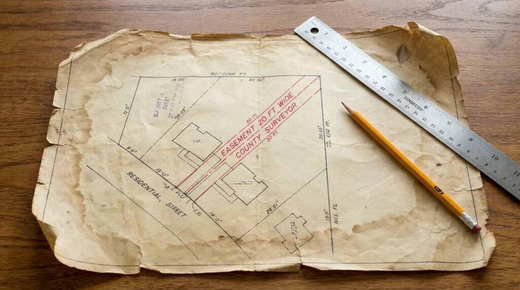
Ask for a survey. A current survey, prepared by a licensed New York surveyor, should plot all easements of record. If the seller has a survey, ask to see it early. If no survey exists, consider ordering one before making an offer on any property where the lot configuration, size, or history suggests easement complexity — waterfront parcels, irregular lots, corner lots, properties adjacent to utility infrastructure.
Ask your attorney to pull the underlying documents. A Schedule B-2 exception that lists an easement by liber and page number means the underlying easement document is in the public record. It can be retrieved from the Suffolk County Clerk. Reading the actual easement — not just its listing in the title commitment — tells you the corridor width, the specific permitted uses, the identity of the easement holder, and whether there are any conditions that might support modification or extinguishment.
Map it on the lot. Once you have the survey and the underlying easement document, ask your attorney to identify where the easement corridor runs on the specific lot and what it means for your intended use. Then compare that to your plans. The question is not whether the easement exists — it does, and it will not go away — but whether it affects what you actually intend to do with this property.
A buyer who does this work before making an offer negotiates from a position of knowledge. A buyer who discovers a significant easement conflict after closing has limited options. As I noted in the post on title commitments and chain of title, the title commitment is a property’s legal biography. The easement section of Schedule B-2 is one of its most consequential chapters — and it deserves more than a passing skim.
This is for informational purposes only — consult a licensed real estate attorney for guidance specific to your transaction.
Real estate markets change. For current listings and market data, contact Pawli at Maison Pawli.