What the Setauket Ferry Landing Left Behind: Reading Port Jefferson’s Harbor Sediment as a Stratigraphic Record of Three Centuries of Commerce
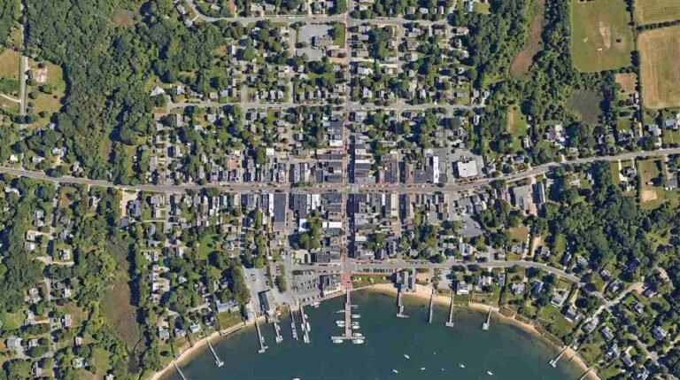
The ferry is departing. You can set your watch by it — the Bridgeport & Port Jefferson, running since 1883, the oldest continuously operating ferry service in the United States. From the bluff above the harbor, watching it push out into the Sound, you see nothing more complex than a routine departure. From below the waterline, at the harbor bottom, the picture is incomparably richer.
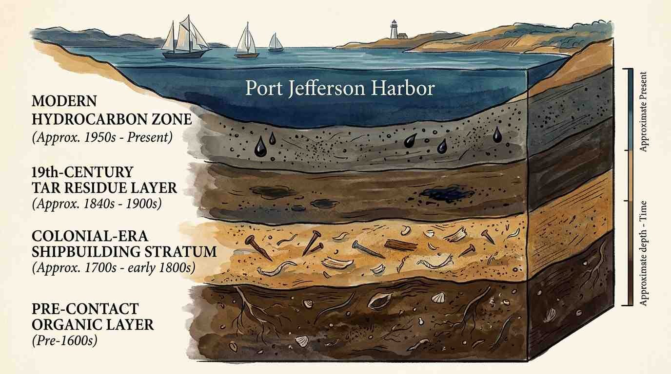
The sediment accumulating on that harbor floor is not neutral fill. It is a stratigraphic archive, laid down in sequence, compressing three centuries of economic life into a column of silt, clay, organic material, and debris that environmental engineers, dredging crews, and the occasional archaeologist have been reading — usually for reasons that have nothing to do with history.
The Canoe Landing Before the Harbor
Port Jefferson Harbor was not built by colonists. It was already in use.
The Setalcott people — a subtribe of the Algonquian-speaking nations who occupied the western shore of Long Island’s north coast — used this cove as a landing for generations before European settlement. The settlement known as Setauket, which names the larger area, preserves that record in its place-name. The Three Village Historical Society holds documentary evidence — early colonial land transaction records, survey notes, and settler accounts — that describe the original landing sites along this stretch of coastline as pre-existing features of the landscape, not colonial constructions.
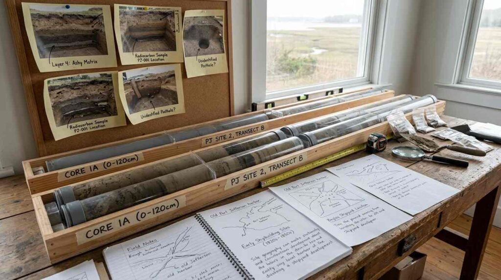
What the Setalcott canoe landings left in the harbor sediment is subtle but not absent. Pre-contact organic deposits — the charred wood, shell refuse, and tool-knapping debris associated with sustained water-edge use — are detectable in sediment cores as anomalous organic layers beneath the colonial-era accumulation. The U.S. Army Corps of Engineers’ Long Island Sound dredging studies, which have produced substantial sediment core data for this harbor system, document those organic anomalies without necessarily interpreting them as archaeological. The interpretation requires a different kind of attention.

The Shipbuilding Stratum
The middle of the stratigraphic column is the most legible.
Port Jefferson’s shipbuilding era — running roughly from the early 19th century through the 1890s — left a distinctive material signature in the harbor sediment. The NYSDEC harbor dredging Environmental Impact Statement documents for Port Jefferson are among the most data-rich sources available for understanding what the shipbuilding period physically deposited in this water body. What the cores pull up from that stratum tells a story in materials: iron filings and fastener fragments from metal working, wood shavings and sawdust deposits from the spar yards and joiners’ shops, tar and pitch residues from caulking operations, coal ash from smithing forges.
The Three Village Historical Society archives document the specific geography of the shipbuilding operations — the yard locations, the launch ramps, the timber storage areas along the harbor edge — in enough detail to map those activities against the sediment core data. When you do that alignment, the stratigraphy stops being abstract. The iron-rich layer in a core from the north basin corresponds to the location of the iron works. The tar-heavy zone corresponds to the documented caulking yard. The harbor bottom is a spatial record of an industry that operated at the surface and deposited its evidence in the ground below.
Port Jefferson’s Second Act as a real estate market is inseparable from that industrial heritage. The harbor that makes this village valuable today was shaped, physically and economically, by the industry whose waste products are now buried beneath it.
The Ferry Dock Footprint
The Bridgeport & Port Jefferson Steamboat Company’s long operation along this harbor has been the subject of archaeological assessment in connection with dock expansion and environmental review processes. The dock footprint — which has shifted and expanded over the company’s 140-year history — is documented in the company’s own historical records, in Army Corps permit files, and in the NYSDEC dredging EIS materials.
What the ferry dock represents archaeologically is a sediment disturbance pattern: repeated dredging to maintain channel depth, propeller wash that redistributes bottom sediments, fuel residues and hull paint compounds that accumulate in the dock basin. The ferry, in other words, is both an archaeological subject and an archaeological agent — it is part of the story the sediment tells, and it is continuously rewriting that story through its ongoing operation.
The layering around the ferry dock footprint is particularly complex precisely because it has been disturbed so many times by maintenance dredging. But disturbance is itself informative. The redeposited sediment in the ferry basin — material churned up from deeper strata and resettled — contains reworked fragments from multiple periods, making the dock area a kind of involuntary assemblage of the harbor’s entire history.
What Environmental Remediation Reads
The NYSDEC dredging EIS documents for Port Jefferson were not produced for archaeologists. They were produced to assess the environmental impact of harbor dredging on water quality, marine habitat, and sediment contamination. The sediment cores they commissioned were analyzed for heavy metals, PCBs, and hydrocarbons — the chemical signature of industrial use — not for pottery sherds or architectural fragments.
But the physical core data is there. And when you read it against the historical record, the chemistry tells an archaeological story. The heavy metal peaks correspond to the smithing and ironwork period. The hydrocarbon signatures date to the transition from sail to steam — the point in the harbor’s history when petroleum-based fuels began replacing the tar and pitch of the wooden shipbuilding era. The PCB profiles reflect mid-20th century industrial activity — paint compounds, electrical insulation materials — from the harbor’s post-shipbuilding commercial life.
Each of those peaks is a timestamp. Each timestamp is a chapter. The harbor is not a passive background to Port Jefferson’s history. It is a participant — absorbing, preserving, and occasionally yielding the physical evidence of everything that happened at its edge.
The Village Above, the Archive Below
I think about this when I’m showing waterfront property in Port Jefferson. The buyers who come here are drawn by the obvious things — the water, the walkability, the ferry connection to the Connecticut shore, the village character that I’ve seen survive pressures that have flattened comparable places up and down the North Shore. Those things are real. The walkability of Port Jefferson Village is something I’ve examined closely, and it has direct implications for how property holds value here.
But the harbor itself — the physical body of water at the center of all of it — is something more than an amenity. It is a document. It has been receiving and preserving the material evidence of human activity on its shores since before the English arrived. The ferry departure you watch from the bluff is the latest entry in a sedimentary record that starts with a Setalcott canoe and runs, in continuous deposition, to the present moment.
That is not a small thing. Very few places on the North Shore carry that depth of unbroken material continuity. It is one of the reasons Port Jefferson is Port Jefferson — not just a village on the water, but a village of the water, in ways that go deeper than the tourist brochure version.
Sources
- NYSDEC harbor dredging EIS documents for Port Jefferson: https://www.dec.ny.gov/permits/
- Three Village Historical Society archives: https://www.tvhs.org
- Bridgeport & Port Jefferson Steamboat Company historical records: https://www.bpjferry.com
- U.S. Army Corps of Engineers Long Island Sound dredging studies: https://www.nan.usace.army.mil