The Lattingtown Landing: Tracing the Buried Footprint of an 18th-Century Oyster Bay Township Landing Site That Gold Coast Development Paved Over but Did Not Erase
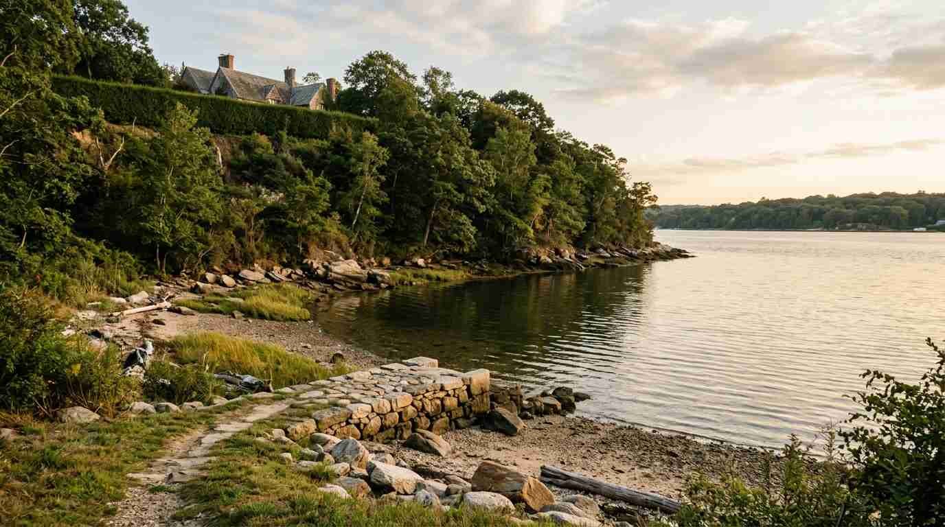
Lattingtown is one of those incorporated villages that presents itself as a fait accompli. The gates, the driveways, the privet hedges, the studied invisibility of the estates behind them — everything in the contemporary landscape communicates permanence, stability, the appearance of things that have always been as they are. The Gold Coast aesthetic depends on this illusion. The mansions look as though they emerged from the landscape fully formed, as though there was no before.
There was a before.
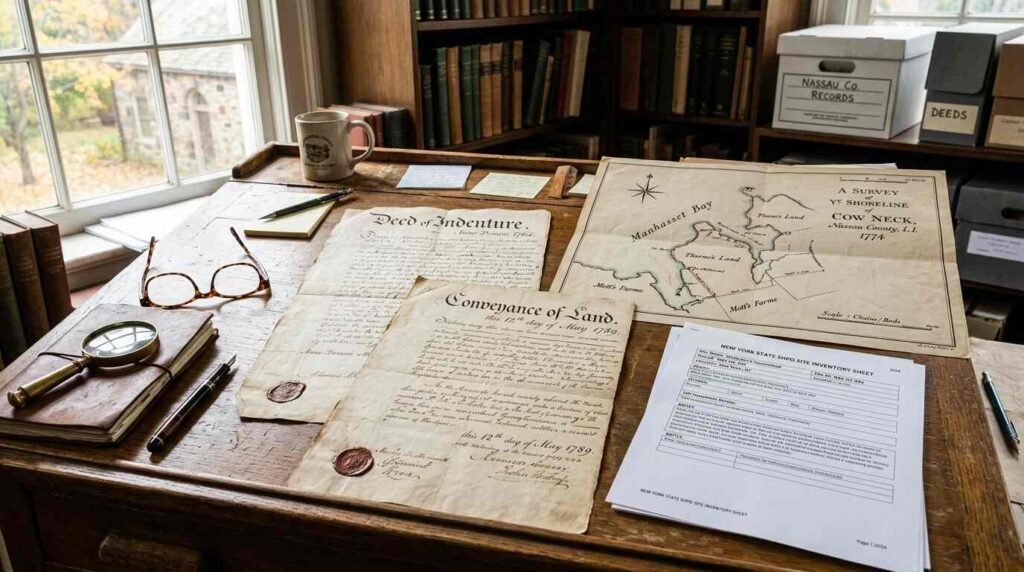
The Nassau County Clerk’s deed records for Oyster Bay Township predate the estate era by two centuries. Colonial-era survey maps document the shoreline of Mill Neck Creek and the western arm of Oyster Bay Cove as a working coast — a landscape of landing sites, fish weirs, small-scale agriculture, and the modest commerce of English colonial communities making use of the water at their edge. The historian Myron Luke’s published work on 18th-century Oyster Bay Township economy provides the documentary framework for understanding what that coast looked like and who used it. Preservation Long Island’s historical collections — the organization founded as the Society for the Preservation of Long Island Antiquities — hold relevant deeds, maps, and estate inventories that locate the pre-estate economy in the specific geography of this shoreline.
What the Gold Coast development of the late 19th and early 20th century did to that shoreline was not erase it. It buried it. And subsurface investigations, along with the SHPO site inventory for Oyster Bay Township, have begun to recover what is underneath.
The Colonial Shore Before the Mansions
The Lattingtown name preserves the record of the family that owned the original colonial-era landholding — the Latting family, English settlers who held substantial acreage in Oyster Bay Township from the late 17th century and whose land use patterns left physical traces in the soil that Gold Coast construction did not eliminate.
What the 18th-century colonial economy of this shoreline included, according to the Oyster Bay Township deed records and the historical scholarship of the period, was a set of activities organized around water access: small-scale fishing, the harvesting of shellfish from the bay shallows, and the operation of the landing sites that gave coastal communities their connection to the Long Island Sound trading network. Landing sites were not dramatic infrastructure — they were typically a sloped, stabilized beach approach, a protected anchorage, and perhaps a simple storage structure. Their physical signature in the archaeological record is subtle: slope modification, stabilizing stone or timber fragments, the accumulated debris of loading and unloading operations.
Preservation Long Island’s historical collections document the Lattingtown area’s colonial-era land use through deed descriptions that reference specific shoreline features — references to coves, to creek crossings, to the rights to fish and to land boats at particular points — that allow the documentary record to be mapped onto the physical landscape. When that mapped record is overlaid against the SHPO site inventory for Oyster Bay Township, the pre-estate shoreline economy becomes spatially legible: where the landings were, where the fish weirs ran, where the small-scale agricultural activity left its deposits.
What Estate Construction Buried
The transformation of the Lattingtown shoreline during the Gold Coast era was systematic and comprehensive. Estates of this period typically involved: the removal of existing structures and landscape features that did not fit the estate aesthetic; the importation of significant quantities of fill to level and regrade the terrain; the construction of carriage drives, wall bases, and outbuilding foundations that involved extensive subsurface disturbance; and the installation of drainage and utility infrastructure that cut through existing soil profiles.
Each of those activities disturbed the pre-existing surface — and in doing so, buried it. Archaeological sites are not destroyed by burial in the way they are destroyed by removal. A 17th-century landing site deposit that has been covered by two feet of imported fill is in some respects better preserved than it would have been if left exposed at the surface: the fill protects it from subsequent disturbance, from plowing, from erosion. The Gold Coast estates, in burying the colonial-era landscape beneath their infrastructure, inadvertently created a preservation context for the very history they were aesthetically suppressing.
This is a pattern that the SHPO site inventory recognizes explicitly. Documented pre-contact and early colonial sites in Oyster Bay Township include locations that are now within the footprints of historic estates. The estates have not destroyed those sites — in many cases, they have preserved them. The challenge is that accessing them for investigation requires working around and through layers of historic fabric that have their own preservation significance.

Subsurface Investigations and What They Show
The SHPO site inventory for Oyster Bay Township has grown incrementally as development projects, infrastructure work, and research investigations have exposed subsurface deposits in the area. The pattern that emerges from that inventory — points of documented or suspected pre-estate occupation distributed along the pre-existing colonial and pre-colonial shoreline — corresponds closely to the documentary record from the deed archives and the historical scholarship.
The fish weir locations inferred from colonial deed descriptions are particularly interesting. Fish weirs — the stake-and-net structures that colonial settlers, adapting Algonquian technology, used to trap fish in tidal channels — left physical traces in the form of preserved wooden stakes in anaerobic shoreline sediments and the accumulated organic debris associated with sustained weir operation. In the right preservation environment — and the oxygen-poor muds of a sheltered cove are exactly the right preservation environment — wooden structural elements from 17th and 18th-century weirs can survive for centuries.
Whether such deposits exist in the protected coves of the Lattingtown shoreline is a question that comprehensive subsurface survey could answer and no comprehensive survey has yet provided. The SHPO inventory flags the area as archaeologically sensitive based on documentary evidence and the general predictive pattern of pre-contact and colonial-era site distribution. The subsurface investigation that would test those predictions against the actual deposits has not been conducted at the scale the site merits.
The Property History beneath the Property History
I think about the Lattingtown shoreline when buyers ask me about Gold Coast–area properties — the estates, the historic reproductions, the properties that sit in the visual and spatial shadow of that development era. What they are buying, in every case, is a property whose legal history extends to the deed records and whose physical history extends considerably further.
Preservation easements on Gold Coast–adjacent properties are a real consideration in this market — they affect renovation budgets, permit timelines, and the range of modifications available to buyers. The archaeological sensitivity of the shoreline adds a layer to that consideration that is less often discussed but equally real: ground disturbance in archaeologically sensitive areas requires SHPO consultation, and the Lattingtown shoreline is exactly the kind of area where that consultation is likely to be triggered.
That is not a deterrent. It is a condition of the landscape — the same condition that makes this shoreline the subject of historical inquiry in the first place. The colonial-era landing is not a burden on the property above it. It is, in the most literal sense, its foundation: the evidence of the human economy that made this coast valuable long before the Gold Coast discovered it.
Sources
- Nassau County Clerk deed records — Oyster Bay Township: https://www.nassaucountyny.gov/agencies/Clerk/
- SHPO site inventory for Oyster Bay Township: https://www.nysparks.com/shpo/
- Preservation Long Island historical collections: https://preservationlongisland.org
- Myron Luke, historian — Oyster Bay Township economic history: published through Nassau County Museum of Art and local historical society collections